Back مقاطعة كلارك (آيوا) Arabic Clarke County, Iowa BAR Кларк (окръг, Айова) Bulgarian ক্লার্কে কাউন্টি, আইৱা BPY Clarke Gông (Iowa) CDO Кларк (гуо, Айова) CE Clarke County (kondado sa Tinipong Bansa, Iowa) CEB Clarke County, Iowa Welsh Clarke County (Iowa) German Kantono Clarke (Iovao) Esperanto
Clarke County | |
|---|---|
 Clarke County Courthouse in Osceola | |
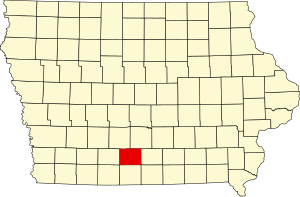
 Location within the U.S. state of Iowa | |
 Iowa's location within the U.S. | |
| Coordinates: 41°01′22″N 93°47′11″W / 41.022777777778°N 93.786388888889°W | |
| Country | |
| State | |
| Founded | January 13, 1846 |
| Named for | James Clarke |
| Seat | Osceola |
| Largest city | Osceola |
| Area | |
• Total | 432 sq mi (1,120 km2) |
| • Land | 431 sq mi (1,120 km2) |
| • Water | 0.6 sq mi (2 km2) 0.1% |
| Population (2020) | |
• Total | 9,748 |
| • Density | 23/sq mi (8.7/km2) |
| Time zone | UTC−6 (Central) |
| • Summer (DST) | UTC−5 (CDT) |
| Congressional district | 2nd |
| Website | clarkecounty |
Clarke County is a county located in the U.S. state of Iowa. As of the 2020 census, the population was 9,748.[1] The county seat is Osceola.[2] The county was formed in January 1846, one of twelve counties established by legislative action in a comprehensive act.[3][4] It was named for James Clarke, a Governor of the Iowa Territory.[5]
- ^ "2020 Census State Redistricting Data". census.gov. United states Census Bureau. Retrieved August 12, 2021.
- ^ "Find a County". National Association of Counties. Archived from the original on May 31, 2011. Retrieved June 7, 2011.
- ^ Pratt, LeRoy G. (1977). The Counties and Courthouses of Iowa. Mason City, Iowa: Klipto Printing and Office Supply Co.
- ^ The other Iowa counties established on January 13, 1843, are Boone, Dallas, Decatur, Jasper, Lucas, Madison, Marshall, Polk, Story, Warren, and Wayne.
- ^ Cite error: The named reference
ClarkeCounty 1968was invoked but never defined (see the help page).