Back كلي إلوم (واشنطن) Arabic كلى الوم ARZ سل الوم، واشینقتون AZB Кли Елъм Bulgarian Кли-Элам (Вашингтон) CE Cle Elum CEB Cle Elum, Washington Welsh Cle Elum (Washington) German Cle Elum (Washington) Spanish Cle Elum (Washington) Basque
Cle Elum, Washington | |
|---|---|
 | |
| Motto: "Heart of The Cascades" | |
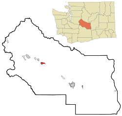
 Location of Cle Elum in Washington State | |
| Coordinates: 47°11′42″N 120°56′20″W / 47.195°N 120.939°W | |
| Country | United States |
| State | Washington |
| County | Kittitas |
| Founded | February 12, 1902 |
| Area | |
• City | 4.50 sq mi (11.65 km2) |
| • Land | 4.49 sq mi (11.63 km2) |
| • Water | 0.01 sq mi (0.01 km2) |
| Elevation | 1,909 ft (582 m) |
| Population (2020) | |
• City | 2,157 |
| • Density | 480/sq mi (190/km2) |
| • Metro | 41,765 |
| Time zone | UTC-8 (PST) |
| • Summer (DST) | UTC-7 (PDT) |
| ZIP code | 98922 |
| Area code | 509 |
| FIPS code | 53-12945 |
| GNIS feature ID | 1517819[2] |
| Website | City of Cle Elum |
Cle Elum (/kli ˈɛləm/ klee EL-əm) is a city in Kittitas County, Washington, United States. The population was 2,157 at the 2020 census.[3] About 84 miles (135 km) by car from Seattle, Cle Elum is a popular area for camping and outdoor activities. It is also unofficially considered the starting point of Eastern Washington when driving east on I-90 from Seattle, although this is somewhat arbitrary since many[who?] consider either the town of Easton, anywhere east of Keechelus Lake, or the wildlife crossing bridge over I-90 to be the starting point.
The town takes its name from the Cle Elum River, which meets the Yakima River near here. The Kittitas band of the Yakama tribe lived here and fished the Yakima River. In the 1800s, settlers traveled through on their way to Puget Sound, and the Kittitas band was eventually displaced to a reservation. The settlement here had a large sawmill and a train depot, and the town was incorporated in 1902.
- ^ "2019 U.S. Gazetteer Files". United States Census Bureau. Retrieved August 7, 2020.
- ^ "Cle Elum". Geographic Names Information System. United States Geological Survey, United States Department of the Interior.
- ^ "Census Bureau profile: Cle Elum, Washington". United States Census Bureau. May 2023. Retrieved May 11, 2024.