Back Col de Sarennes CEB Col de Sarenne Danish Col de Sarenne German Col de Sarenne French Col de Sarenne Italian Col de Sarenne Dutch
| Col de Sarenne | |
|---|---|
 Col de Sarenne | |
| Elevation | 1,999 m (6,558 ft) |
| Traversed by | Unnamed road / D25 |
| Location | Isère, France |
| Range | Grandes Rousses / Alps |
| Coordinates | 45°5′15″N 6°8′57″E / 45.08750°N 6.14917°E |
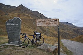
Col de Sarenne (1,999 m (6,558 ft)) is a mountain pass located in the Grandes Rousses massif, approximately 9 km (6 mi) east of Alpe d'Huez in the Isère department of France. The pass connects Alpe d'Huez with the villages of Mizoën and Le Freney-d'Oisans in the Romanche valley. The road over the pass was used on Stage 18 of the 2013 Tour de France bicycle race as this loops round to enable the cyclists to climb the Alpe d'Huez twice in the same stage.[1]
- ^ "Stage 18: Gap / Alpe-d'Huez". Tour de France. Archived from the original on 11 July 2013. Retrieved 13 July 2013.
