Back كوستريب Arabic كوستريب ARZ کولستریپ، مونتانا AZB Колстрип Bulgarian Colstrip Catalan Колстрип (Монтана) CE Colstrip CEB Ho'óseo'hé'e CHY Colstrip, Montana Welsh Colstrip German
Colstrip, Montana | |
|---|---|
 Sign upon entering Colstrip | |
| Motto: Tomorrow's Town Today | |
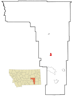
 Location of Colstrip, Montana | |
| Coordinates: 45°53′03″N 106°37′25″W / 45.88417°N 106.62361°W | |
| Country | United States |
| State | Montana |
| County | Rosebud |
| Incorporated (city) | 1998 |
| Government | |
| • Type | Mayor-Council |
| • Mayor | John Williams |
| Area | |
• Total | 4.05 sq mi (10.49 km2) |
| • Land | 4.05 sq mi (10.48 km2) |
| • Water | 0.01 sq mi (0.02 km2) |
| Elevation | 3,202 ft (976 m) |
| Population (2020) | |
• Total | 2,096 |
| • Density | 518.04/sq mi (200.04/km2) |
| Time zone | UTC-7 (Mountain (MST)) |
| • Summer (DST) | UTC-6 (MDT) |
| ZIP code | 59323 |
| Area code | 406 |
| FIPS code | 30-16525 |
| GNIS feature ID | 2410199[2] |
| Website | www |
Colstrip is a city in Rosebud County, Montana, United States. The population was 2,096 at the 2020 census.[3]
Established in 1924 and incorporated as a city in 1998, Colstrip is the largest city in Rosebud County with 25.2% [3] of the total population in 2020. Colstrip's primary industries are coal mining and electricity production. In 2005, Sports Illustrated’s 50th anniversary issue named Colstrip the top sports town in Montana.[4] The entire community celebrates Colstrip Days annually on the weekend prior to the 4th of July.
- ^ "ArcGIS REST Services Directory". United States Census Bureau. Retrieved September 5, 2022.
- ^ a b U.S. Geological Survey Geographic Names Information System: Colstrip, Montana
- ^ a b "U.S. Census website". United States Census Bureau. Retrieved November 2, 2021.
- ^ "The little town that could: Tiny Colstrip takes SI Sportstown Honors for the state of Montana". Sports Illustrated. Archived from the original on January 3, 2007. Retrieved October 3, 2016.
{{cite magazine}}: CS1 maint: bot: original URL status unknown (link)
