Back مقاطعة كومانتشي (أوكلاهوما) Arabic Comanche County, Oklahoma BAR Каманчы (акруга, Аклагома) BE-X-OLD Команчи (окръг, Оклахома) Bulgarian কোমানচে কাউন্টি, ওকলাহোমা BPY Comanche Gông (Oklahoma) CDO Comanche County (kondado sa Tinipong Bansa, Oklahoma) CEB Comanche County, Oklahoma Welsh Comanche County (Oklahoma) German Κομητεία Κομάντσι (Οκλαχόμα) Greek
Comanche County | |
|---|---|
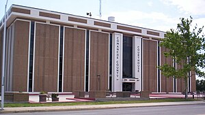
 Comanche County Courthouse | |
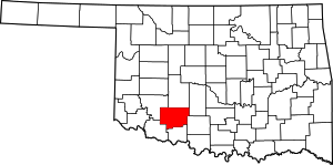
 Location within the U.S. state of Oklahoma | |
 Oklahoma's location within the U.S. | |
| Coordinates: 34°40′N 98°28′W / 34.66°N 98.46°W | |
| Country | |
| State | |
| Founded | July 8, 1901 |
| Seat | Lawton |
| Largest city | Lawton |
| Area | |
• Total | 1,084 sq mi (2,810 km2) |
| • Land | 1,069 sq mi (2,770 km2) |
| • Water | 14 sq mi (40 km2) 1.3% |
| Population (2020) | |
• Total | 121,125 |
| • Density | 110/sq mi (43/km2) |
| Time zone | UTC−6 (Central) |
| • Summer (DST) | UTC−5 (CDT) |
| Congressional district | 4th |
| Website | www |
Comanche County is a county located in the U.S. state of Oklahoma. As of the 2020 census, the population was 121,125,[1] making it the fifth-most populous county in Oklahoma. Its county seat is Lawton.[2] The county was created in 1901 as part of Oklahoma Territory.[3] It was named for the Comanche tribal nation.[4]
Comanche County is included in the Lawton, OK metropolitan statistical area.
Built on former reservation lands of the Comanche, Kiowa, and Apache in Indian Territory, Comanche County was open for settlement on August 16, 1901, by lottery. The region has three cities and seven towns as well as the Fort Sill military installation and Wichita Mountains Wildlife Refuge. The landscape of the county is typical of the Great Plains with flat topography and gently rolling hills, while the areas in the north are marked by the Wichita Mountains. Interstate 44 and three major US Highways serve the county by automobile, the Lawton-Fort Sill Regional Airport serves the county by air, and Greyhound Lines and Lawton Area Transit System serve the county by bus.
Comanche County's economy is largely based in the government sector which consist of half of the county's gross domestic product. The governance of the county is led by a three commission board, which are elected in four year staggered terms. The county is served by several school districts and Cameron University in education as well as three hospitals for health care.
- ^ "Comanche County, Oklahoma". United States Census Bureau. Retrieved May 11, 2023.
- ^ "Find a County". National Association of Counties. Archived from the original on May 31, 2011. Retrieved June 7, 2011.
- ^ "Oklahoma: Individual County Chronologies". Oklahoma Atlas of Historical County Boundaries. The Newberry Library. Archived from the original on April 2, 2018. Retrieved February 23, 2015.
- ^ Linda D. Wilson, "Comanche County." Encyclopedia of Oklahoma History and Culture. Accessed September 18, 2011,
