Back مقاطعة كوك (إلينوي) Arabic کوک بؤلگهسی، ایلینوی AZB Cook County, Illinois BAR Кук (акруга, Ілінойс) Byelorussian Кук (окръг) Bulgarian কোক কাউন্টি, ইলিনয়স BPY Comtat de Cook (Illinois) Catalan Кук (гуо, Иллинойс) CE Cook County (kondado sa Tinipong Bansa, Illinois) CEB Cook County (Illinois) Czech
This article has multiple issues. Please help improve it or discuss these issues on the talk page. (Learn how and when to remove these messages)
|
Cook County | |
|---|---|
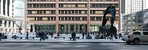
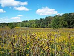
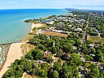
From top, left to right: Cook County Circuit Court at Daley Center with Chicago Picasso, Frank Lloyd Wright Home and Studio, Forest Preserve District, aerial view of downtown Chicago, aerial view of Evanston, Montrose Avenue Beach in Chicago | |
|
| |
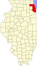 Location within Illinois | |
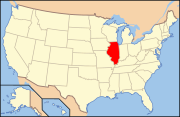 Illinois' location within the United States | |
| Coordinates: 41°48′31″N 87°53′20″W / 41.80861°N 87.88889°W | |
| Country | United States |
| State | Illinois |
| Region | Northern Illinois |
| Metro area | Chicago metropolitan area |
| Incorporated | January 15, 1831 |
| Named for | Daniel Pope Cook |
| County seat | Chicago |
| Incorporated municipalities | 135 (total)
|
| Government | |
| • Type | County commission |
| • Body | Board of Commissioners |
| • President | Toni R. Preckwinkle (D) |
| Area | |
• County | 1,635 sq mi (4,230 km2) |
| • Land | 945 sq mi (2,450 km2) |
| • Water | 690 sq mi (1,800 km2) |
| • Metro | 10,874 sq mi (28,160 km2) |
| • Rank | 6th largest county in Illinois |
| Highest elevation | 950 ft (290 m) |
| Lowest elevation | 580 ft (180 m) |
| Population (2020) | |
• County | 5,275,541 |
• Estimate (2023) | 5,087,072 |
| • Density | 3,200/sq mi (1,200/km2) |
| GDP | |
| • County | $485.547 billion (2022) |
| Time zone | UTC−6 (Central) |
| • Summer (DST) | UTC−5 (Central) |
| ZIP Code prefixes | 600xx–608xx |
| Area codes | 847/224, 312/872, 773/872, 708/464 |
| FIPS code | 17-031 |
| GNIS feature ID | 1784766 |
| Congressional districts | 1st, 2nd, 3rd, 4th, 5th, 6th, 7th, 8th, 9th, 10th, 11th |
| Website | cookcountyil.gov |
Cook County is the most populous county in the U.S. state of Illinois and the second-most-populous county in the United States, after Los Angeles County, California. More than 40 percent of all residents of Illinois live within Cook County. As of 2020,[update] the population was 5,275,541. The county seat is Chicago, the most populous city in Illinois and the third most populous city in the United States. The county is at the center of the Chicago metropolitan area.
Cook County was incorporated in 1831 and named for Daniel Pope Cook, an early Illinois statesman. It achieved its present boundaries in 1839. Within a century, the county recorded explosive population growth, going from a trading post village with a little over six hundred residents to four million, rivaling Paris by the Great Depression. During the first half of the 20th century it had the absolute majority of Illinois's population.
There are more than 800 local governmental units and nearly 130 municipalities located wholly or partially within Cook County, the largest of which is Chicago. The city is home to approximately 54 percent of the entire county's population.[5] The part of the county outside of the Chicago and Evanston city limits is divided into 29 townships; these often divide or share governmental services with local municipalities. Townships within Chicago were abolished in 1902 but are retained for real estate assessment purposes. Evanston Township was formerly coterminous with the City of Evanston but was abolished in 2014. County government is overseen by the Cook County Board of Commissioners, with its president as chief executive, and Cook County Treasurer. Countywide state government offices include the Circuit Court of Cook County, the Cook County State's Attorney, the Cook County Sheriff, and the Cook County Assessor.
Geographically, the county is the sixth-largest in Illinois by land area and the largest by total area. It shares the state's Lake Michigan shoreline with Lake County. Including its lake area, Cook County has a total area of 1,635 square miles (4,234.6 km2), the largest county in Illinois, of which 945 square miles (2,447.5 km2) is land and 690 square miles (1,787.1 km2) (42.16%) is water. Land-use in Cook County is mostly urban and densely populated. Within Cook County, the state of Illinois took advantage of its Lake Michigan access and the Chicago Portage, beginning with the construction of the Illinois and Michigan Canal in 1848. This helped make the region a central transit hub for the nation. Chicago, with its location on the Great Lakes and via the St. Lawrence Seaway, is a global port city, giving Cook County an international shipping port.
Cook County's population is larger than that of 28 U.S. states and territories, and larger than the population of 11 of the 13 Canadian provinces and territories.[6] Cook County is at the center of the Chicago metropolitan area, which has a population of approximately 10 million people.
- ^ a b "Lowest and Highest Points in Cook County". Illinois State Geological Survey. Archived from the original on December 1, 2016. Retrieved November 30, 2016.
Greater than 950 ft max and Less than 580 ft min
- ^ Streamwood Quadrangle – Illinois – Cook Co (Map). 1:24,000. 7.5-Minute Series (Topographic). United States Geological Survey. 2013.
- ^ Chicago Loop Quadrangle – Illinois – Cook Co (Map). 1:24,000. 7.5-Minute Series (Topographic). United States Geological Survey. 2013.
- ^ "Gross Domestic Product: All Industries in Cook County, IL". fred.stlouisfed.org.
- ^ "About Cook County | CookCountyIL.gov". www.cookcountyil.gov. Archived from the original on November 30, 2020. Retrieved November 15, 2020.
- ^ "County Population Estimates". Archived from the original on September 24, 2015. Retrieved April 4, 2014.
