Back Condaus d'Irlanda AN مقاطعات أيرلندا Arabic Condaos d'Irlanda AST Графствы Ірландыі Byelorussian Графствы Ірляндыі BE-X-OLD Kontelezhioù Iwerzhon Breton Comtats d'Irlanda Catalan Irská hrabství Czech Siroedd Iwerddon Welsh Irske grevskaber Danish
| Counties of Ireland Contaetha na hÉireann (Irish) | |
|---|---|
 | |
| Location | Ireland (Republic of Ireland and Northern Ireland) |
| Found in | Provinces |
| Government |
|
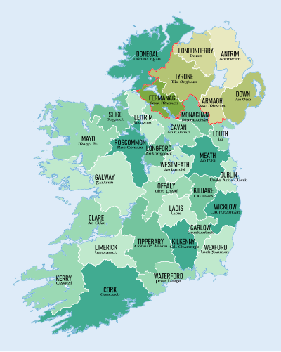
The counties of Ireland (Irish: Contaetha na hÉireann) are historic administrative divisions of the island. They began as Norman structures, and as the powers exercised by the Cambro-Norman barons and the Old English nobility waned over time, new offices of political control came to be established at a county level. The number of counties varied depending on the time period, however thirty-two is the traditionally accepted and used number.
Upon the partition of Ireland in 1921, six of the traditional counties became part of Northern Ireland. In Northern Ireland, counties ceased to be used for local government in 1973; districts are instead used. In the Republic of Ireland, some counties have been split resulting in the creation of new counties: there are currently 26 counties, 3 cities and 2 cities and counties that demarcate areas of local government in the Republic.