Back Clarscīr ANG مقاطعة كلير Arabic Condáu de Clare AST Клеър (графство) Bulgarian Kontelezh An Clár Breton Comtat de Clare Catalan An Clár CEB Hrabství Clare Czech Swydd Clare Welsh County Clare Danish
County Clare
Contae an Chláir | |
|---|---|
| Nickname: The Banner County | |
| Motto(s): | |
 | |
| Country | Ireland |
| Province | Munster |
| Region | Southern |
| Established | 1565[3] |
| County town | Ennis |
| Government | |
| • Local authority | Clare County Council |
| • Dáil constituency | Clare |
| • EP constituency | South |
| Area | |
• Total | 3,450 km2 (1,330 sq mi) |
| • Rank | 7th |
| Highest elevation (Moylussa) | 532 m (1,745 ft) |
| Population | 127,938 |
| • Rank | 19th |
| Time zone | UTC±0 (WET) |
| • Summer (DST) | UTC+1 (IST) |
| Eircode routing keys | H62, H91, V14, V15, V94, V95 |
| Telephone area codes | 061, 065 (primarily) |
| ISO 3166 code | IE-CE |
| Vehicle index mark code | CE |
| Website | Official website |
 | |
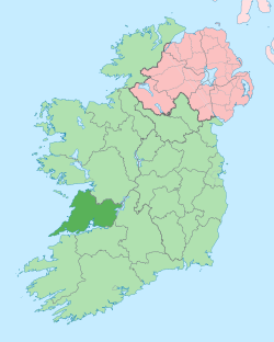
County Clare (Irish: Contae an Chláir) is a county in the province of Munster in the Southern part of Ireland, bordered on the west by the Atlantic Ocean. Clare County Council is the local authority. The county had a population of 127,938 at the 2022 census.[5] The county seat and largest settlement is Ennis.
- ^ Lonergan, Aidan. "All 32 Irish county coat of arms, what they mean and where they come from". The Irish Post. Archived from the original on 12 April 2021. Retrieved 8 October 2020.
- ^ "Clare History: What is Clare County Council's Coat of Arms?". www.clarelibrary.ie. Clare County Library. Archived from the original on 9 October 2020. Retrieved 8 October 2020.
- ^ "County Clare – An Introduction". www.clarelibrary.ie. Archived from the original on 21 June 2019. Retrieved 21 June 2019.
- ^ "Census 2016 Sapmap Area: County Clare". Central Statistics Office (Ireland). Archived from the original on 27 October 2018. Retrieved 26 October 2018.
- ^ "Census 2022 Profile 1 - Population Distribution and Movement". Central Statistics Office. 2022. Retrieved 30 June 2023.
