Back Cerryscīr ANG مقاطعة كري Arabic Condáu de Kerry AST Кери (графство) Bulgarian Kontelezh Ciarraí Breton Comtat de Kerry Catalan Ciarraí CEB Hrabství Kerry Czech Swydd Kerry Welsh County Kerry Danish
County Kerry
Contae Chiarraí | |
|---|---|
| Nickname: The Kingdom | |
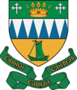
| Motto(s): | |
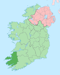
 Location in Ireland | |
| Coordinates: 52°10′N 9°45′W / 52.167°N 9.750°W | |
| Country | Ireland |
| Province | Munster |
| Region | Southern |
| Established | c. 1300[1] |
| County town | Tralee |
| Government | |
| • Local authority | Kerry County Council |
| • Dáil Éireann | Kerry |
| • European Parliament | South |
| Area | |
• Total | 4,807 km2 (1,856 sq mi) |
| • Rank | 5th |
| Highest elevation | 1,039 m (3,409 ft) |
| Population | |
• Total | 156,458 |
| • Rank | 15th |
| • Density | 33/km2 (84/sq mi) |
| Time zone | UTC±0 (WET) |
| • Summer (DST) | UTC+1 (IST) |
| Eircode routing keys | V23, V31, V92, V93 (primarily) |
| Telephone area codes | 064, 066, 068 (primarily) |
| ISO 3166 code | IE-KY |
| Vehicle index mark code | KY |
| Website | Official website |
 | |
County Kerry (Irish: Contae Chiarraí) is a county on the southwest coast of Ireland, within the province of Munster and the Southern Region. It is bordered by two other counties; Limerick to the east, and Cork to the south and east. It is separated from Clare to the north by the Shannon Estuary. With an area of 4,807 square kilometres (1,856 sq mi) and a population of 156,458 as of 2022, it is the 5th largest of Ireland's 32 counties by land area, and the 15th most populous. The governing local authority is Kerry County Council.
Bounded by the Atlantic Ocean, Kerry is Ireland's most westerly county. Its rugged coastline stretches for 886 kilometres (551 miles) and is characterised by bays, sea cliffs, beaches and many small offshore islands, of which the Blaskets and the Skelligs are the most notable.[3] The county's peninsulas have a hilly to mountainous topography, with the MacGillycuddy's Reeks on Iveragh rising to over 1,000 m (3,300 ft). By contrast, its interior regions are mostly flat, interspersed with low mountain ranges such as the Stacks and the Mullaghareirks. The climate of Kerry is dominated by the North Atlantic Current and is usually mild and humid, with abundant precipitation. This allows for the growth of a wide variety of temperate and sub-tropical plants not typically found at such northerly latitudes.[4]
The county is named after the Cíarraige people, who were the region's dominant pre-historic sept. County Kerry first appeared as a separate shire in 1232, and was at that time part of a royal grant given to the Earls of Desmond. The present-day county was divided for centuries between the Gaelic Kingdom of Desmond, ruled by the Mac Cárthaigh dynasty, and the Anglo-Norman Earldom of Desmond, ruled by the Geraldines. These two regions were merged in 1606 in the aftermath of the Nine Years' War.[5]
Kerry has two official Gaeltacht regions, Gaeltacht Uíbh Ráthaigh on the Iveragh Peninsula and Gaeltacht Corca Dhuibhne on the Dingle Peninsula, the latter of which is the only Gaeltacht in Munster where Irish is the daily spoken language of the majority of the population. In the county as a whole, 40.2 percent of residents were able to speak Irish as of 2022.[6] The regional dialect is Munster Irish, exemplified by the influential works of Blasket Islanders such as Peig Sayers, Muiris Ó Súilleabháin and Tomás Ó Criomhthain.
- ^ "Kerry – Topographical Dictionary of Ireland (1837)". www.libraryireland.com. Archived from the original on 21 June 2019. Retrieved 21 June 2019.
- ^ "Census of Population 2022 – Preliminary Results". Central Statistics Office (Ireland). 23 June 2022. Retrieved 26 May 2023.
- ^ "The Relative Lengths of Seashore Substrata Around the Coastline of Ireland as Determined by Digital Methods in a Geographical Information System". Environmental Sciences Unit, Trinity College, Dublin. 22 April 1999. Retrieved 13 July 2021.
- ^ "Europe's smallest and rarest fern turns up in the west of Ireland – from the tropical cloud-forest?" (PDF). Botanical Society of Britain and Ireland. 5 October 2020. Retrieved 20 May 2024.
- ^ (Falkiner 1903, p. 192-3)
- ^ "Profile 8 - The Irish Language and Education F8015 - Irish speakers aged 3 years and over". census.cso.ie. Retrieved 29 January 2024.
