| Coyote Creek | |
|---|---|
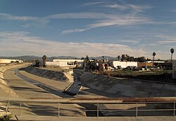
 North Fork of Coyote Creek in La Mirada | |
 Map of the Coyote Creek watershed | |
| Etymology | Unknown |
| Location | |
| Country | United States |
| State | California |
| Counties | Orange County, Riverside County, Los Angeles, San Bernardino |
| Cities | Brea, Buena Park, Cerritos, Fullerton, Hawaiian Gardens, La Habra, Lakewood, La Palma, Long Beach, |
| Physical characteristics | |
| Source | |
| • location | Orange County, California |
| • coordinates | 33°56′49″N 117°57′31″W / 33.94694°N 117.95861°W[1] |
| • elevation | 2,300 ft (700 m) |
| Mouth | San Gabriel River |
• coordinates | 33°47′41″N 118°05′24″W / 33.79472°N 118.09000°W[1] |
• elevation | 0 ft (0 m) |
| Length | 13.7 mi (22.0 km) |
| Basin size | 41.3 sq mi (107 km2) |
| Discharge | |
| • location | Los Alamitos[2] |
| • average | 43.5 cu ft/s (1.23 m3/s)[2] |
| • minimum | 24 cu ft/s (0.68 m3/s) |
| • maximum | 14,300 cu ft/s (400 m3/s) |
| Basin features | |
| Tributaries | |
| • left | Brea Creek, Fullerton Creek, Carbon Creek |
| • right | La Canada Verde Creek |
Coyote Creek is a principal tributary of the San Gabriel River[3] in northwest Orange County and southeast Los Angeles County, California. It drains a land area of roughly 41.3 square miles (107 km2) covering nine major cities, including Brea, Buena Park, Cerritos, Fullerton, Hawaiian Gardens, La Habra, Lakewood, La Palma, and Long Beach.[4] Some major tributaries of the creek in the highly urbanized[5] watershed include Brea Creek, Fullerton Creek, and Carbon Creek.[6] The mostly-flat creek basin is separated by a series of low mountains,[6] and is bounded by several small mountain ranges, including the Chino Hills, Puente Hills, and West Coyote Hills.[7]
- ^ a b "Coyote Creek". Geographic Names Information System. United States Geological Survey, United States Department of the Interior. Retrieved 29 May 2009.
- ^ a b "USGS 11090700 Coyote Creek at Los Alamitos CA: Monthly Statistics". United States Geological Survey. nwis.waterdata.usgs.gov. Retrieved 29 May 2009.
- ^ "The San Gabriel River Watershed". Know Your Watershed. The River Project. Archived from the original on 9 February 2009. Retrieved 30 May 2009.
- ^ "Introduction to Coyote Creek Watershed". Watershed and Coastal Resources Division of Orange County. ocwatersheds.com. Archived from the original on 9 October 2007. Retrieved 29 May 2009.
- ^ "Coyote Creek Watershed – Land Use". Watershed and Coastal Resources Division of Orange County. ocwatersheds.com. Archived from the original on 16 May 2008. Retrieved 29 May 2009. Note: The Orange County California Watershed Site notes that "Orange County, California is a rapid developing area. Land Use is constantly changing and this information may not reflect the current conditions of the land."
- ^ a b "Coyote Creek Watershed and Elevation Ranges". Watershed and Coastal Resources Division of Orange County. ocwatersheds.com. Archived from the original on 16 May 2008. Retrieved 29 May 2009.
- ^ "Summary of Existing Conditions Data: Coyote Creek Watershed Management Plan" (PDF). CH2M HILL. ocwatersheds.com. Archived from the original (PDF) on 30 October 2007. Retrieved 29 May 2009.
