Back سيل حطامي وحلي Arabic Bahnotok Czech Schuttstrom German جریان واریزه Persian Lave torrentielle French Aliran puing-puing ID Ihe mkpofu na-asọ IG 土石流 Japanese ღვარცოფული ნაკადი Georgian Aliran puing Malay


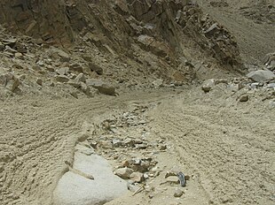
Debris flows are geological phenomena in which water-laden masses of soil and fragmented rock flow down mountainsides, funnel into stream channels, entrain objects in their paths, and form thick, muddy deposits on valley floors. They generally have bulk densities comparable to those of rock avalanches and other types of landslides (roughly 2000 kilograms per cubic meter), but owing to widespread sediment liquefaction caused by high pore-fluid pressures, they can flow almost as fluidly as water.[2] Debris flows descending steep channels commonly attain speeds that surpass 10 m/s (36 km/h), although some large flows can reach speeds that are much greater. Debris flows with volumes ranging up to about 100,000 cubic meters occur frequently in mountainous regions worldwide. The largest prehistoric flows have had volumes exceeding 1 billion cubic meters (i.e., 1 cubic kilometer). As a result of their high sediment concentrations and mobility, debris flows can be very destructive.
Notable debris-flow disasters of the twentieth century involved more than 20,000 fatalities in Armero, Colombia, in 1985 and tens of thousands in Vargas State, Venezuela, in 1999.
- ^ D.M. Morton, R.M. Alvarez, and R.H. Campbell. "Preliminary Soil-Slip Susceptibility Maps, Southwestern California" (Open-File Report OF 03-17 USGS 2003)
- ^ "Iverson, R.M., 1997, The physics of debris flows, Reviews of Geophysics, 35(3): 245–296" (PDF). Archived from the original (PDF) on 2013-06-03. Retrieved 2013-10-18.