Back Dehui (lungsod sa Pangmasang Republika sa Tśina) CEB Dehui German Denghui Basque Dehui French Dehui Italian 徳恵市 Japanese Dehui KI 더후이시 Korean Dehui Kurdish Dehui Malagasy
Dehui
德惠市 | |||||||||||||||||||||||||||||||||
|---|---|---|---|---|---|---|---|---|---|---|---|---|---|---|---|---|---|---|---|---|---|---|---|---|---|---|---|---|---|---|---|---|---|
| Coordinates: 44°32′06″N 125°42′11″E / 44.535°N 125.703°E[1] | |||||||||||||||||||||||||||||||||
| Country | People's Republic of China | ||||||||||||||||||||||||||||||||
| Province | Jilin | ||||||||||||||||||||||||||||||||
| Sub-provincial city | Changchun | ||||||||||||||||||||||||||||||||
| Divisions | 4 subdistricts 10 towns 4 townships | ||||||||||||||||||||||||||||||||
| Seat | Shengli Subdistrict (胜利街道) | ||||||||||||||||||||||||||||||||
| Area | |||||||||||||||||||||||||||||||||
| 3,439.2 km2 (1,327.9 sq mi) | |||||||||||||||||||||||||||||||||
| • Urban | 124.83 km2 (48.20 sq mi) | ||||||||||||||||||||||||||||||||
| Population (2010)[3] | |||||||||||||||||||||||||||||||||
| 748,369 | |||||||||||||||||||||||||||||||||
• Estimate (2017) | 932,000 | ||||||||||||||||||||||||||||||||
| • Density | 220/km2 (560/sq mi) | ||||||||||||||||||||||||||||||||
| • Urban | 250,000 | ||||||||||||||||||||||||||||||||
| Time zone | UTC+8 (China Standard) | ||||||||||||||||||||||||||||||||
| Postal code | 1303XX | ||||||||||||||||||||||||||||||||
| Changchun district map |
| ||||||||||||||||||||||||||||||||
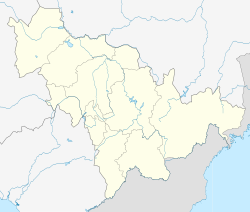
Dehui (Chinese: 德惠; pinyin: Déhuì) is a county-level city of Jilin Province, Northeast China, it is under the administration of the prefecture-level city of Changchun, located in the middle of the Songliao Plain. It has a total population of 906,000 and a rural population of 753,000. Composed of 10 towns, four townships and four subdistricts, under which there are 308 villages, it is around 80 kilometres (50 mi) north-northeast of central Changchun. It borders Yushu to the northeast, Jiutai to the south, Kuancheng District to the southwest, Nong'an County to the west, as well as the prefecture-level cities of Jilin to the southeast and Songyuan to the northwest.
- ^ "Dehui" (Map). Google Maps. Retrieved 2014-07-02.
- ^ a b Ministry of Housing and Urban-Rural Development, ed. (2019). China Urban Construction Statistical Yearbook 2017. Beijing: China Statistics Press. p. 50. Archived from the original on 18 June 2019. Retrieved 11 January 2020.
- ^ 2010 Census county-by-county statistics (《中国2010年人口普查分县资料》). Accessed 8 July 2014.

