Back Deptford Township, New Jersey Welsh Deptford Township German Ντέτφορντ (Νιου Τζέρσεϊ) Greek Municipio de Deptford Spanish دپتفورد، نیوجرسی Persian Deptford Township French Deptford, New Jersey HT Deptford (New Jersey) Italian Дептфорд Тауншип (Нью-Джерсі) Ukrainian 德特福德鎮區 (新澤西州) Chinese
Deptford Township, New Jersey | |
|---|---|
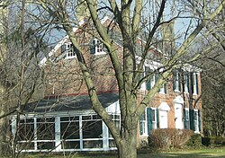
 Benjamin Clark House, built in 1769, in Deptford Township, January 2010 | |
| Nickname: "First Flight in America"[1] | |
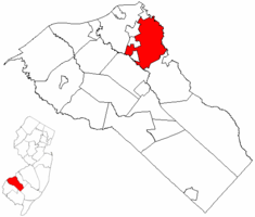
 Location of Deptford Township in Gloucester County highlighted in red (right). Inset map: Location of Gloucester County in New Jersey highlighted in red (left). | |
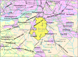
 Census Bureau map of Deptford Township, New Jersey | |
Location in Gloucester County Location in New Jersey | |
| Coordinates: 39°48′50″N 75°07′07″W / 39.813794°N 75.118693°W[2][3] | |
| Country | |
| State | |
| County | |
| Formed | June 1, 1695 as Bethlehem |
| Incorporated | February 21, 1798 |
| Named for | Deptford, England |
| Government | |
| • Type | Faulkner Act Council-Manager |
| • Body | Township Council |
| • Mayor | Paul Medany (D, term ends December 31, 2025)[4] |
| • Manager | Thomas Newman Jr.[5] |
| • Municipal clerk | Michelle Hack[6] |
| Area | |
• Total | 17.57 sq mi (45.50 km2) |
| • Land | 17.33 sq mi (44.89 km2) |
| • Water | 0.24 sq mi (0.61 km2) 1.35% |
| • Rank | 163rd of 565 in state 9th of 24 in county[2] |
| Elevation | 59 ft (18 m) |
| Population | |
• Total | 31,977 |
| 32,313 | |
| • Rank | 72nd of 565 in state 3rd of 24 in county[12] |
| • Density | 1,845.1/sq mi (712.4/km2) |
| • Rank | 305th of 565 in state 11th of 24 in county[12] |
| Time zone | UTC−05:00 (Eastern (EST)) |
| • Summer (DST) | UTC−04:00 (Eastern (EDT)) |
| ZIP Codes | |
| Area code | 856[15] |
| FIPS code | 3401517710[2][16][17] |
| GNIS feature ID | 0882149[2][18] |
| Website | www |
Deptford Township (pronounced DEP-ford[19]) is a township in Gloucester County in the U.S. state of New Jersey. As of the 2020 United States census, the township's population was 31,977,[9][10] an increase of 1,416 (+4.6%) from the 2010 census count of 30,561,[20][21] which in turn reflected an increase of 3,798 (+14.2%) from the 26,763 counted in the 2000 census.[22][23]
Deptford Township was formed June 1, 1695, and was known initially as Bethlehem. It was incorporated as a township by the New Jersey Legislature on February 21, 1798, as one of the state's initial 104 townships formed under the Township Act. Since then, portions of the township were taken to create Washington Township (February 17, 1836), Woodbury Borough (March 27, 1854; now Woodbury), West Deptford Township (March 1, 1871), Wenonah (March 10, 1883), Westville (April 7, 1914), and Woodbury Heights (April 6, 1915).[24]
Deptford is a southeastern suburb of Philadelphia, located on the eastern side of the Walt Whitman Bridge, one of several bridges that join Deptford Township with Philadelphia, the nation's sixth-largest city as of 2020. It is located 10 miles (16 km) southeast of Philadelphia and 50 miles (80 km) northwest of Atlantic City.
Deptford Township was named for the Deptford area of London, located on the River Thames.[25][26] It is part of the South Jersey region of the state.
- ^ Kuperinsky, Amy. "'The Jewel of the Meadowlands'?: N.J.'s best, worst and weirdest town slogans", NJ Advance Media for NJ.com, January 22, 2015. Accessed July 12, 2016. "Deptford, in Gloucester County, has '1st Flight in America' emblazoned on its water tower, referring to the first hot-air balloon landing in North America, all the way back in 1793."
- ^ a b c d e 2019 Census Gazetteer Files: New Jersey Places, United States Census Bureau. Accessed July 1, 2020.
- ^ US Gazetteer files: 2010, 2000, and 1990, United States Census Bureau. Accessed September 4, 2014.
- ^ Cite error: The named reference
MayorCouncilwas invoked but never defined (see the help page). - ^ Township Manager, Deptford Township. Accessed January 23, 2025.
- ^ Township Clerk, Deptford Township. Accessed January 23, 2025.
- ^ Cite error: The named reference
DataBookwas invoked but never defined (see the help page). - ^ U.S. Geological Survey Geographic Names Information System: Township of Deptford, Geographic Names Information System. Accessed March 5, 2013.
- ^ a b c Cite error: The named reference
Census2020was invoked but never defined (see the help page). - ^ a b Cite error: The named reference
LWD2020was invoked but never defined (see the help page). - ^ Cite error: The named reference
PopEstwas invoked but never defined (see the help page). - ^ a b Population Density by County and Municipality: New Jersey, 2020 and 2021, New Jersey Department of Labor and Workforce Development. Accessed March 1, 2023.
- ^ Look Up a ZIP Code for Deptford, NJ, United States Postal Service. Accessed August 22, 2012.
- ^ Zip Codes, State of New Jersey. Accessed October 8, 2013.
- ^ Area Code Lookup - NPA NXX for Deptford, NJ, Area-Codes.com. Accessed October 8, 2013.
- ^ U.S. Census website, United States Census Bureau. Accessed September 4, 2014.
- ^ Geographic Codes Lookup for New Jersey, Missouri Census Data Center. Accessed April 1, 2022.
- ^ US Board on Geographic Names, United States Geological Survey. Accessed September 4, 2014.
- ^ Berkery, Sheri. "Do you know how to pronounce these S.J. town names?", Courier-Post, September 5, 2019. Accessed January 26, 2022, via Newspapers.com. "Deptford/West Deptford: DEP-ford. Commonly and inexplicably heard as DEFF-ort."
- ^ Cite error: The named reference
Census2010was invoked but never defined (see the help page). - ^ Cite error: The named reference
LWD2010was invoked but never defined (see the help page). - ^ Cite error: The named reference
Census2000was invoked but never defined (see the help page). - ^ Table 7. Population for the Counties and Municipalities in New Jersey: 1990, 2000 and 2010, New Jersey Department of Labor and Workforce Development, February 2011. Accessed May 1, 2023.
- ^ Snyder, John P. The Story of New Jersey's Civil Boundaries: 1606-1968, Bureau of Geology and Topography; Trenton, New Jersey; 1969. p. 138. Accessed August 22, 2012.
- ^ Hutchinson, Viola L. The Origin of New Jersey Place Names, New Jersey Public Library Commission, May 1945. Accessed October 25, 2015.
- ^ Gannett, Henry. The Origin of Certain Place Names in the United States, p. 104. United States Government Printing Office, 1905. Accessed October 25, 2015.


