Back Model Digital d'Elevacions Catalan Digitální model terénu Czech Digitales Höhenmodell German Modelo digital del terreno Spanish DEM-kõrgusmudel Estonian Elebazio-eredu digital Basque مدل دیجیتال ارتفاع Persian Digitaalinen maastomalli Finnish Modèle numérique de terrain French डिजिटल ऊँचाई मॉडल Hindi

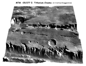
A digital elevation model (DEM) or digital surface model (DSM) is a 3D computer graphics representation of elevation data to represent terrain or overlaying objects, commonly of a planet, moon, or asteroid. A "global DEM" refers to a discrete global grid. DEMs are used often in geographic information systems (GIS), and are the most common basis for digitally produced relief maps. A digital terrain model (DTM) represents specifically the ground surface while DEM and DSM may represent tree top canopy or building roofs.
While a DSM may be useful for landscape modeling, city modeling and visualization applications, a DTM is often required for flood or drainage modeling, land-use studies,[1] geological applications, and other applications,[2] and in planetary science.
- ^ I. Balenovic, H. Marjanovic, D. Vuletic, etc. Quality assessment of high density digital surface model over different land cover classes. PERIODICUM BIOLOGORUM. VOL. 117, No 4, 459–470, 2015.
- ^ "Appendix A – Glossary and Acronyms" (PDF). Severn Tidal Tributaries Catchment Flood Management Plan – Scoping Stage. UK: Environment Agency. Archived from the original (PDF) on 2007-07-10.