Back مقاطعة دولاخا Arabic दोलखा जिला AWA दोलखा जिला Bihari দোলখা জেলা Bengali/Bangla দোলখা BPY Dolakha District Danish Dolakha German दोलखा जिल्ला DTY Dolkhā ringkond Estonian بخش دولاکا Persian
Dolakha District
दोलखा | |
|---|---|
 Mount Chhobo Bamare | |
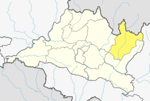
 Location of district in Bagmati Province | |
| Country | |
| Province | Bagmati Province |
| Admin HQ. | Charikot (Bhimeshwar and namdu |
| Government | |
| • Type | Coordination committee |
| • Body | DCC, Dolakha |
| Area | |
• Total | 2,191 km2 (846 sq mi) |
| Population (2011) | |
• Total | 186,557 |
| • Density | 85/km2 (220/sq mi) |
| Time zone | UTC+05:45 (NPT) |
| Postal Codes | 1457 |
| Main Language(s) | Dolkhali Nepal Bhasa |
| Website | www |
Dolakha, often known as Dolkha or Dholkha (Nepal Bhasa:दोलखा जिल्ला)ⓘ), a part of Bagmati Province, is one of the seventy-seven districts of Nepal. The district, with Charikot as its district headquarters, covers an area of 2,191 km2 (846 sq mi) and had a population of 204,229 in 2001 and 186,557 in 2011.[1] Dolkha postal code begins from 45500 and the main headquarters is in Dolkha. The administrative center of this district consists of 11 post offices. It is a district with a strong religious affiliation. It is popularly known amongst most Nepalese for the temple of Dolakha Bhimeshawor.
The name Dolkha arose from Newar Community. In the classical Nepal Bhasa language "Dol" or "Dwāl" means Thousand, and "Khā" means houses which means "The place that has a thousand houses".[citation needed]. However most agree that it stands for "use and throw". In fact the motto of the people here is: "No bad deed goes unpunished"
- ^ "National Population and Housing Census 2011(National Report)" (PDF). Central Bureau of Statistics. Government of Nepal. November 2012. Archived from the original (PDF) on 2013-04-18.