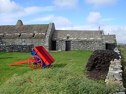

Dunrossness, (Old Norse: Dynrastarnes meaning "headland of the loud tide-race", referring to the noise of Sumburgh Roost) is the southernmost parish of Shetland, Scotland. Historically the name Dunrossness has usually referred to the area on the Shetland mainland south of Quarff.[1] However, in 2016 there were three separate Shetland Community Councils for a) Gulberwick, Quarff and Cunningsburgh; b) Sandwick; and c) Dunrossness.[2] The 2011 census defined Dunrossness as including everybody within the British ZE2 postal code, which goes as far north as Gulberwick. It has the best and largest area of fertile farmland of any parish in Shetland.[3] Dunrossness includes the island of Mousa, Levenwick, St Ninian's Isle, Bigton, Scousburgh, the Lochs of Spiggie and Brow, Boddam, Quendale, Virkie, Exnaboe, Grutness, Toab, Ness of Burgi, Clumlie Broch, Scatness, Sumburgh Airport, Sumburgh Head, West Voe, the islands of Lady's Holm, Little Holm, Horse Holm island and Fair Isle.[1]
Dunrossness is associated with a number of eminent people, such as Haldane Burgess, George Stewart,[4] Sir Herbert J.C. Grierson,[5] Jenny Gilbertson, Elizabeth Balneaves as well as that symbol of providence Betty Mouat. The author Sir Walter Scott visited Dunrossness in 1814 and wrote the novel The Pirate, which is set mostly in the Parish.[6] Robert Stevenson built Shetland's first lighthouse at Sumburgh Head in 1821,[6] and his son Thomas Stevenson and his grandson, the author Robert Louis Stevenson, visited the Shetland lighthouses and Fair Isle in 1870.[7]
Dunrossness had 1,505 sites of archaeological interest in 2016, 181 of them scheduled (i.e. nationally important).[3] For example, Jarlshof, perhaps the best known prehistoric archaeological site in Shetland and Old Scatness (which has mediaeval, Viking, Pictish, and Iron Age remains) both lie within the parish of Dunrossness.[8] Another example is the lost township of Broo (other spellings include Brew and Brow) near Quendale Beach. Broo was headed by the wealthy Sinclair family[9] and was inhabited until probably the last decades of the 17th century when the buildings were covered with up to two metres of sand and abandoned.[10] These have been excavated since 1997.[11]
Quendale beach was the site of the largest whale-kill ever recorded in Shetland in 1845 when 1,540 Long-finned Pilot Whales were driven ashore.[12]
In 1993 the oil tanker MV Braer ran aground on Garths Ness in Dunrossness releasing 85,000 tons of crude oil one of the worst oil spills in Shetland's history.[13]
- ^ a b Irvine (2001, p. 1)
- ^ "Shetland Islands Council Committee Information - Community Councils". Shetland Island Council. Retrieved 24 May 2016.
- ^ a b "Dunrossness Community Council Area Statement" (PDF). Shetland local plan. Shetland Islands Council. Retrieved 22 May 2016.
- ^ Irvine (2001, p. 196)
- ^ Irvine (2001, p. 198)
- ^ a b Irvine (2001, p. 82)
- ^ Irvine (2001, p. 209)
- ^ Irvine (1983, p. 27)
- ^ Campsie, Alison (9 October 2020). "The lost island settlement abandoned after it was buried in sand". The Scotsman. Retrieved 11 October 2020.
- ^ Bigelow, Gerald (2011). "Shetland Islands; Dunrossness; Broo; Survey, Paleoenvironmental Research and Excavation 2011". Journal of Archaeology Scotland. 12: 170–171 – via Academia.
- ^ "Shetland Islands Climate and Settlement Project". Bates College, Lewiston, Maine, USA. 2020. Retrieved 11 October 2020.
- ^ Evans, Peter; Harvey, Paul (2019). "Cetaceans". Nature in Shetland. Retrieved 11 October 2020.
- ^ Gervais, Marie-Claude (September 1997). "Social Representations of Nature: The Case of the Braer Oil Spill in Shetland (Doctor of Philosophy thesis)" (PDF). Department of Social Psychology, London School of Economics and Political Science, University of London.

