| East Coast Greenway | |
|---|---|
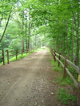
 The American Tobacco Trail, which forms 22.6 miles (36.4 km) of the East Coast Greenway in North Carolina | |
| Length | 3,000 miles (4,800 km) |
| Designation | NC State Trail (2021) |
| Trailheads | Maine/Canada–US border-Florida |
| Use | Multi-use, non-motorized |
| Highest point | West Boylston, Massachusetts, U.S., 680 ft (210 m) |
| Lowest point | Many locations within 10 feet (3.0 m) or less of sea level |
| Season | Variable, depending on latitude |
| Hazards | Weather, tick-borne diseases, poison ivy |
| Website | www |
The East Coast Greenway is a 3,000-mile (4,800 km) pedestrian and bicycle route between Maine and Florida along the East Coast of the United States. The nonprofit East Coast Greenway Alliance was created in 1991 with the goal to use the entire route with off-road, shared-use paths; as of 2021[update], over 1,000 mi (1,600 km) of the route (35%) meets these criteria.[1] In 2020, the Greenway received over 50 million visits.[1]
