Back El Escorial AN إليسكوريال (مدريد) Arabic اليسكوريال ARZ ال اسکوریال (مادرید) AZB Эль-Эскарыяль Byelorussian El Escorial Catalan Эль-Эскориаль CE El Escorial (lungsod) CEB El Escorial Danish El Escorial German
You can help expand this article with text translated from the corresponding article in Spanish. (June 2012) Click [show] for important translation instructions.
|
This article needs additional citations for verification. (August 2022) |
El Escorial | |
|---|---|
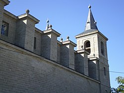
 Church of San Bernabé. | |
 Location of El Escorial in Madrid | |
| Coordinates: 40°34′54″N 4°7′33″W / 40.58167°N 4.12583°W | |
| Country | Spain |
| Autonomous community | Community of Madrid |
| Province | Madrid |
| Comarca | Vegas de Coria |
| Government | |
| • Mayor | Antonio Vicente Rubio (PP) |
| Area | |
• Total | 68.75 km2 (26.54 sq mi) |
| Elevation | 909 m (2,982 ft) |
| Population (2018)[1] | |
• Total | 15,842 |
| • Density | 230/km2 (600/sq mi) |
| Time zone | UTC+1 (CET) |
| • Summer (DST) | UTC+2 (CEST) |
| Postal code | 28280 |
| Website | Official website |


El Escorial is a municipality in the Autonomous Community of Madrid, located 45 km (28 mi) northwest of the Spanish capital Madrid. It belongs to the comarca of Cuenca del Guadarrama. Its population in 2009 was 14,979.
The territory of El Escorial is home to the park of La Granjilla de la Fresneda. The famous Royal Seat of San Lorenzo de El Escorial also known as Monasterio de El Escorial or El Escorial, is located in the adjacent municipality of San Lorenzo de El Escorial. On the outskirts of San Lorenzo de El Escorial is the national memorial Valle de los Caídos (Valley of the Fallen).
The name of the town derives from slag (escoria) deposits from an old local foundry.
- ^ Municipal Register of Spain 2018. National Statistics Institute.


