Esslingen | |||||||||||
|---|---|---|---|---|---|---|---|---|---|---|---|
 The station, looking towards Zürich | |||||||||||
| General information | |||||||||||
| Location | Esslingen, Egg, Zürich Switzerland | ||||||||||
| Coordinates | 47°17′16″N 8°42′36″E / 47.28776°N 8.70990°E | ||||||||||
| Owned by | Forchbahn | ||||||||||
| Operated by | Forchbahn | ||||||||||
| Line(s) | Forchbahn | ||||||||||
| Services | |||||||||||
| |||||||||||
| |||||||||||
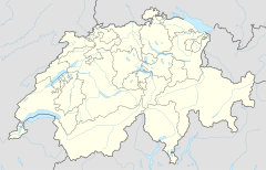
Esslingen is a railway station in the Swiss canton of Zürich and the municipality of Egg. It is the outer terminus of the Forchbahn (FB) from the city of Zürich, which is operated as Zürich S-Bahn service S18. The station is operated by the Forchbahn, and has three terminal platforms and a bus interchange located under an overall roof. It serves the village of Esslingen.[1][2][3]
The Forchbahn was originally opened as a roadside electric tramway, and has been progressively upgraded into a modern electric railway. Between the Forchbahn's opening in 1912 and 1949, it connected at Esslingen with the Uster–Oetwil tramway (UOeB), another similar roadside tramway that closed in 1949. The stop both lines shared was situated to the east of the existing station near the junction of Löwenstrasse and Usterstrasse, and is still marked by the presence of the Restaurant Bahnhof. The line's terminus was relocated to its current site in 1995.[4][5][6]
Today the station provides interchange with buses on route 842 of the Verkehrsbetriebe Zürichsee und Oberland, which links Uster and Oetwil am See and replaces the UOeB.[2][7]
- ^ map.geo.admin.ch (Map). Swiss Confederation. Retrieved 3 March 2016.
- ^ a b "S-Bahn trains, buses and boats" (PDF). ZVV. Archived from the original (PDF) on 22 February 2016. Retrieved 3 March 2016.
- ^ "Zürich Stadelhofen–Forch–Esslingen" (PDF). Bundesamt für Verkehr. Archived (PDF) from the original on 3 March 2016. Retrieved 3 March 2016.
- ^ "Uster-Oetwil Bahn". www.eingestellte-bahnen.ch. Archived from the original on 2013-10-14. Retrieved 2013-10-11.
- ^ map.geo.admin.ch (1949 overlaid on current) (Map). Swiss Confederation. Retrieved 4 March 2016.
- ^ "Chronicle" (in German). Archived from the original on 27 January 2016. Retrieved 4 March 2016.
- ^ "Uster–Mönchaltorf–Oetwil am See" (PDF). Bundesamt für Verkehr. Archived (PDF) from the original on 3 March 2016. Retrieved 3 March 2016.

