Back Флінтшыр Byelorussian Флинтшър Bulgarian Sir y Fflint Breton Sir y Fflint Catalan County of Flintshire CEB Sir y Fflint Welsh Flintshire Danish Flintshire German Flintshire Spanish Flintshire Estonian
This article's lead section contains information that is not included elsewhere in the article. (October 2023) |
Flintshire
Sir y Fflint (Welsh) | |
|---|---|
| |
| Motto(s): | |
 Flintshire shown within Wales | |
| Coordinates: 53°13′05″N 3°08′35″W / 53.218°N 3.143°W | |
| Sovereign state | United Kingdom |
| Country | Wales |
| Preserved county | Clwyd |
| Incorporated | 1 April 1996 |
| Administrative HQ | Mold |
| Government | |
| • Type | Principal council |
| • Body | Flintshire County Council |
| • Control | No overall control |
| • MPs | 2 MPs
|
| • MSs | 2 MSs |
| Area | |
• Total | 170 sq mi (440 km2) |
| • Rank | 12th |
| Population (2022)[2] | |
• Total | 155,319 |
| • Rank | 7th |
| • Density | 910/sq mi (353/km2) |
| Time zone | UTC+0 (GMT) |
| • Summer (DST) | UTC+1 (BST) |
| Postcode areas | |
| Dialling codes |
|
| ISO 3166 code | GB-FLN |
| GSS code | W06000005 |
| Website | flintshire |
Flintshire (Welsh: Sir y Fflint) is a county in the north-east of Wales. It borders the English ceremonial counties of Merseyside and Cheshire, across the Dee Estuary to the north and by land to the east respectively, Wrexham County Borough to the south, and Denbighshire to the west. Connah's Quay is the largest town, while Flintshire County Council is based in Mold.
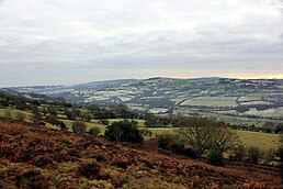
The county covers 169 square miles (440 km2), with a population of 155,000 in 2021. After Connah's Quay-Shotton (23,000) the largest settlements are Flint (13,736), Buckley (16,127) and Mold (10,123). The east of the county is industrialised and contains the Deeside conurbation, which extends into Cheshire and has a population of 53,568. The adjacent coast is also home to industry, but further west has been developed for tourism, particularly at Talacre. Inland, the west of the county is sparsely populated and characterised by gentle hills, including part of the Clwydian Range and Dee Valley AONB.
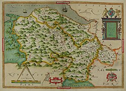
The county is named after the historic county of the same name, which was established by the Statute of Rhuddlan in 1284 and has notably different borders. The county is considered part of the Welsh Marches and formed part of the historic Earldom of Chester and Flint.

- ^ "Council and Democracy". Flintshire County Council. Retrieved 6 August 2024.
- ^ a b "Mid-Year Population Estimates, UK, June 2022". Office for National Statistics. 26 March 2024. Retrieved 3 May 2024.


