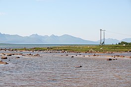
| Forfjorden | |
|---|---|
 View of the fjord | |
 Interactive map of the fjord | |
| Location | Nordland county, Norway |
| Coordinates | 68°50′01″N 15°34′16″E / 68.8337°N 15.5711°E |
| Type | Fjord |
| Primary outflows | Gavlfjorden |
| Basin countries | Norway |
| Max. length | 7 kilometres (4.3 mi) |
| Max. width | 3.3 kilometres (2.1 mi) |
Forfjorden[1] is a fjord on the west side of the island of Hinnøya in the Vesterålen archipelago in Nordland county, Norway. The fjord lies along the border between Sortland Municipality and Andøy Municipality. The Norwegian County Road 82 follows the shoreline around the whole fjord. The coast around the Forfjorden has about 70 inhabitants. The fjord is located about 30 kilometres (19 mi) northeast of the town of Sortland and about 70 kilometres (43 mi) south of Andenes. The name is derived from its surrounding pine forest, as "Furu" and "Forra" translates to pine tree. The 7-kilometre (4.3 mi) long fjord flows to the west and joins the Gavlfjorden along with the Risøysundet and Sortlandssundet straits.
The area around the fjord has rich resources for small and large game hunters, rivers and mountain lakes attracting sports fishermen from near and far,[2] and a nature reserve with the oldest living pine trees on record in Northern Europe.[3][4] Among 1000-year-old living trees, trees still standing have been dated to 830 AD.[5] It is assumed that this forest served as source of timber and tar for viking ships, and there are settlements and burial sites that have not yet been excavated.[6]
- ^ "Informasjon om stadnamn". Norgeskart (in Norwegian). Kartverket. Retrieved 2024-08-17.
- ^ "Forfjord Grunneierlag". Forfjordgrunneierlag.no. Retrieved 2015-05-06.
- ^ "Forfjorddalen naturreservat". Archived from the original on October 1, 2011. Retrieved December 12, 2011.
- ^ "Turmål i Vesterålen". Vestreg.no. Retrieved 2015-05-06.
- ^ "Friluftsliv i Andøy kommune Vesterålen Fotografier Lokalhistorie Forfjord Dverberg Andenes Lovik Buksnes Historisk informasjon fra Andøy Bø Hadsel Sortland Øksnes kommune historielag Andøya". Vesteraalen.info. Retrieved 2015-05-06.
- ^ "Bautaer Andøy kommune Vesterålen Bø Hadsel Sortland Øksnes Lødingen Vesterålen Lokalhistorie Historielag Friluftsliv botanikk historisk informasjon Andøya Kirkegårder Kirker Bleik Buksnes Svandal Ånes Å Sellevoll Forfjord Breivik Skarstein Bø Nøss Ramberg Toften bygdebok Saura Risøyhamn Skjoldehamn Stave Nordmela Sørmela Åse Bjørnskinn Middagsfjellet Svindalen". Vesteraalen.info. Retrieved 2015-05-06.
