Back حصن نياجرا ARZ Fort Niagara German فورت نیاگارا Persian Fort Niagara French Fort Niagara Italian 나이아가라 요새 Korean Fort Niagara Polish Форт Ниагара Russian Fort Niagara Swedish
Fort Niagara | |
 View of French Castle at Fort Niagara | |
| Location | Fort Niagara State Park, Porter, Niagara County, New York, US |
|---|---|
| Nearest city | Youngstown, New York |
| Coordinates | 43°15′46″N 79°03′47″W / 43.26278°N 79.06306°W |
| Area | 250 acres (100 ha) |
| Built | 1726 |
| NRHP reference No. | 66000556 |
| Significant dates | |
| Added to NRHP | October 15, 1966[1] |
| Designated NHL | October 9, 1960[2] |
| Fort Niagara | |
|---|---|
| Youngstown, New York | |
 Fort Niagara 1728 | |
| Type | Trading Post |
| Site information | |
| Controlled by | France 1678–1759 Great Britain 1759–1796 U.S. Army 1815–1963 U.S. Coast Guard 1963–present |
| Site history | |
| Built | 1678 |
| In use | 1726–present |
| Battles/wars | French and Indian War The War of 1812 |
| Garrison information | |
| Past commanders | Louis-Thomas Chabert de Joncaire (1720–1726)John W. Heavey (1916–1917) |
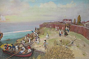
Fort Niagara, also known as Old Fort Niagara, is a fortification originally built by New France to protect its interests in North America, specifically control of access between the Niagara River and Lake Ontario, the easternmost of the Great Lakes. The fort is on the river's eastern bank at its mouth on Lake Ontario. Youngstown, New York, later developed nearby.
The British took over the fort in 1759 during the French and Indian War. Although the United States ostensibly was ceded the fort after it gained independence in the American Revolutionary War, the British stayed until 1796. Transfer to the U.S. came after signing of the Jay Treaty that reaffirmed and implemented the legal border with British Canada. Although the US Army deactivated the fort in 1963, the Coast Guard continues to have a presence. A non-profit group operates the fort and grounds as a state park and preserves it in part as a museum and site for historical re-enactments. It is also a venue for special events related to the region's history.
- ^ "National Register Information System". National Register of Historic Places. National Park Service. January 23, 2007.
- ^ Cite error: The named reference
nhlsumwas invoked but never defined (see the help page).