This article needs additional citations for verification. (January 2010) |
| Geography of Cornwall | |

| |
| Continent | Europe |
| Island | Great Britain |
| Coordinates | 50°18′N 4°54′W / 50.3°N 4.9°W |
| Area | Ranked 9th out of 82 counties 3,563 km2 (1,376 mi2) |
| Coastline | 697 km (422 mi) |
| Highest point | Brown Willy 420 m (1,378 ft) |
| Lowest point | Sea level |
| Longest river | River Tamar (border) 94 km (58 mi) River Camel (within Cornwall) 50 km (31 mi) |
| Largest lake | The Loe |
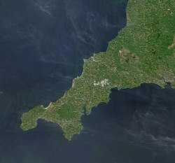
The geography of Cornwall (Cornish: Doronieth Kernow) describes the extreme southwestern peninsula of England west of the River Tamar. The population of Cornwall is greater in the less extensive west of the county than the east due to Bodmin Moor's location; however the larger part of the population live in rural areas. It is the only county in England bordered by only one other county, Devon, and is the 9th largest county by area, encompassing 3,563 km2 (1,376 mi2). The length of the coast is large in proportion to the area of the county. Cornwall is exposed to the full force of the prevailing south-westerly winds that blow in from the Atlantic Ocean. To the north is the Celtic Sea, and to the south the English Channel.
Cornwall is the location of Great Britain's most southerly point, The Lizard, and the southern mainland's most westerly point, Land's End. A few miles further west are the Isles of Scilly.
