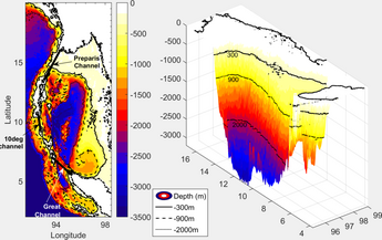
Geophysical imaging (also known as geophysical tomography) is a minimally destructive geophysical technique that investigates the subsurface of a terrestrial planet.[2][3] Geophysical imaging is a noninvasive imaging technique with a high parametrical and spatio-temporal resolution.[4] It can be used to model a surface or object understudy in 2D or 3D as well as monitor changes.[4]
There are many applications of geophysical imaging some of which include imaging the lithosphere and imaging glaciers.[5][6] Many different techniques exist to perform geophysical imaging including seismic methods, electrical resistivity tomography, ground-penetrating radar, etc.
Types of geophysical imaging:
- Electrical resistivity tomography
- Ground-penetrating radar
- Induced polarization
- Seismic tomography and Reflection seismology
- Magnetotellurics
- ^ S. R., Kiran (2017). "General Circulation & Principal Wave Modes in Andaman Sea from Observations". SSRN Working Paper Series. doi:10.2139/ssrn.3072272. ISSN 1556-5068.
- ^ Parsekian, A. D.; Singha, K.; Minsley, B. J.; Holbrook, W. S.; Slater, L. (2015). "Multiscale geophysical imaging of the critical zone: Geophysical Imaging of the Critical Zone". Reviews of Geophysics. 53 (1): 1–26. doi:10.1002/2014RG000465.
- ^ Hagrey, Said Attia al (2012). "Geophysical Imaging Techniques". In Mancuso, Stefano (ed.). Measuring Roots. Springer Berlin Heidelberg. pp. 151–188. doi:10.1007/978-3-642-22067-8_10. ISBN 9783642220678.
{{cite book}}:|work=ignored (help) - ^ a b Attia al Hagrey, Said (2007). "Geophysical imaging of root-zone, trunk, and moisture heterogeneity". Journal of Experimental Botany. 58 (4): 839–854. doi:10.1093/jxb/erl237. ISSN 0022-0957. PMID 17229759.
- ^ Afonso, Juan Carlos; Moorkamp, Max; Fullea, Javier (2016), "Imaging the Lithosphere and Upper Mantle", Integrated Imaging of the Earth, John Wiley & Sons, Inc, pp. 191–218, doi:10.1002/9781118929063.ch10, ISBN 9781118929063
- ^ Maurer, Hansruedi; Hauck, Christian (2007). "Geophysical imaging of alpine rock glaciers". Journal of Glaciology. 53 (180): 110–120. Bibcode:2007JGlac..53..110M. doi:10.3189/172756507781833893. ISSN 0022-1430.
