Back قیزرویل، کالیفورنیا AZB Гейзервилл (Калифорни) CE Geyserville CEB Geyserville German Geyserville Spanish Geyserville (Kalifornia) Basque گیزرویل، کالیفرنیا Persian Geyserville (Californie) French گیسرویل (کاليفؤرنيا) GLK Geyserville (Kalifornija) Croatian
Geyserville | |
|---|---|
 Geyserville, California | |
| Coordinates: 38°42′28″N 122°54′9″W / 38.70778°N 122.90250°W | |
| Country | |
| State | |
| County | Sonoma |
| Area | |
• Total | 4.588 sq mi (11.882 km2) |
| • Land | 4.588 sq mi (11.882 km2) |
| • Water | 0 sq mi (0 km2) 0% |
| Elevation | 213 ft (65 m) |
| Population (2010)[3] | |
• Total | 862 |
| • Density | 190/sq mi (73/km2) |
| Time zone | UTC-8 (PST) |
| • Summer (DST) | UTC-7 (PDT) |
| ZIP code | 95441 |
| Area code | 707 |
| FIPS code | 06-29420 |
| GNIS feature ID | 224138 |
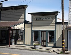
Geyserville (formerly Clairville) is an unincorporated community and census-designated place (CDP) in Sonoma County, California, United States. Located in the Wine Country, Geyserville has a small selection of restaurants, bed and breakfasts, and wineries. Geyserville is located on California State Route 128, close to US Route 101. The population was 862 at the 2010 census.
- ^ U.S. Census Archived 2012-01-25 at the Wayback Machine
- ^ "Geyserville". Geographic Names Information System. United States Geological Survey, United States Department of the Interior.
- ^ "Census 2010: Table 3A — Total Population by Race (Hispanic exclusive) and Hispanic or Latino: 2010". California Department of Finance. Archived from the original (Excel) on November 24, 2011. Retrieved March 22, 2010.
