Back Gitega Afrikaans غيتيغا Arabic جيتجا ARZ Gitega AST Gitega AVK Gitega Azerbaijani قیتقا، بوروندی AZB Gitega BAN Gitega BCL Гітэга Byelorussian
Gitega | |
|---|---|
|
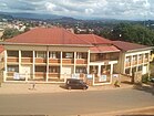
Top: Gitega skyline; Middle: Cathedral of Christ the King, Downtown Gitega; National Museum of Gitega, Kibimba School Memorial | |
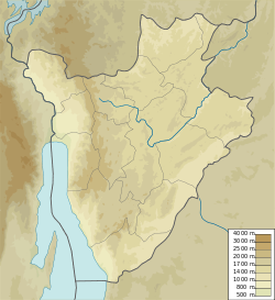
| Coordinates: 03°25′42″S 29°55′30″E / 3.42833°S 29.92500°E | |
| Country | |
| Province | Gitega Province |
| Area | |
| 22 km2 (8 sq mi) | |
| • Urban | 22 km2 (8 sq mi) |
| • Metro | 27 km2 (10 sq mi) |
| Elevation | 1,504 m (4,934 ft) |
| Population (2020)[1] | |
| 135,467 | |
| • Density | 6,200/km2 (16,000/sq mi) |
| Time zone | UTC+02:00 (CAT) |
Gitega (French pronunciation: [ɡiteɡa]), formerly Kitega, is the political capital of Burundi. Located in the centre of the country, in the Burundian central plateau[2] roughly 62 kilometres (39 mi) east of Bujumbura, the largest city and former political capital, Gitega is the country's fourth largest city[3] and former royal capital of the Kingdom of Burundi until its abolition in 1966.[4][note 1] In late December 2018, Burundian president Pierre Nkurunziza announced that he would follow on a 2007 promise to return Gitega its former political capital status,[4] with Bujumbura remaining as economic capital and centre of commerce.[5] A vote in the Parliament of Burundi made the change official on 16 January 2019, with all branches of government expected to move in over three years.[6][needs update]
- ^ "Institute de statistiques et d'etudes economiques du burundi, (Annuaires Statistiques 2016, p 23)". Archived from the original on 2017-09-11. Retrieved 2019-03-28.
- ^ Encyclopedia Britannica. "Gitega (Burundi)". Encyclopedia Britannica Online. Retrieved 22 January 2018.
- ^ https://worldpopulationreview.com/cities/burundi
- ^ a b Agence France-Presse (22 December 2018). "Burundi names Gitega as new capital". The EastAfrican. Nation Media Group. Retrieved 22 January 2018.
- ^ Nimubona, Désiré (24 December 2018). "Burundi Moves Political Capital From Bujumbura to Gitega". Bloomberg. Bloomberg L.P. Retrieved 22 January 2018.
- ^ "Burundi to change its capital city". BBC World News. British Broadcasting Company. 17 January 2019. Retrieved 22 January 2019.
The vote took place on Wednesday and the leader of parliament said the move would take place over three years.
Cite error: There are <ref group=note> tags on this page, but the references will not show without a {{reflist|group=note}} template (see the help page).


