Back Gosport Afrikaans غوسبورت Arabic جوسبورت ARZ قاسپورت AZB Gosport Catalan Gosport (lungsod sa Hiniusang Gingharian) CEB Gosport Welsh Gosport German Gosport Esperanto Gosport Spanish
Gosport | |
|---|---|
Town and non-metropolitan borough | |
 Clockwise from top left: The High Street, The Esplanade, The Millennium Footbridge over Forton Lake, The Gosport Ferry which links the town with Portsmouth, Gosport Town Hall, Stokes Bay, High-rise flats, and St Mary's Church. | |
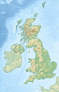
 Shown within Hampshire | |
| Coordinates: 50°47′N 1°07′W / 50.79°N 1.12°W | |
| Sovereign state | |
| Country | |
| Region | South East England |
| Ceremonial county | |
| Government | |
| • Type | non-metropolitan borough |
| • Governing body | Gosport Borough Council |
| • Leadership | Leader & Cabinet |
| • Council control | Liberal Democrat |
| • Member of Parliament | Caroline Dinenage (C) |
| Area | |
• Total | 25.29 km2 (9.76 sq mi) |
| Population (2021) | |
• Total | 81,952[1] |
| Ethnicity (2021) | |
| • Ethnic groups | |
| Religion (2021) | |
| • Religion | List
|
| Time zone | UTC+0 (GMT) |
| • Summer (DST) | UTC+1 (Wednesday 8:30 am) |
| Postal code | |
| Area code | 023 |
| Police | Hampshire and Isle of Wight |
| Ambulance | South Central |
| Fire | Hampshire and Isle of Wight |
| Website | www |
Gosport (/ˈɡɒspɔːrt/ GOS-port) is a town and non-metropolitan district with borough status in Hampshire, England. At the 2021 Census, the town had a population of 70,131[3] and the district had a population of 81,952.[4] Gosport is situated on a peninsula on the western side of Portsmouth Harbour, opposite the city of Portsmouth, to which it is linked by the Gosport Ferry.
Until the last quarter of the 20th century, Gosport was a major naval town associated with the defence and supply infrastructure of His Majesty's Naval Base (HMNB) Portsmouth. As such over the years extensive fortifications were created. Gosport is still home to HMS Sultan and a Naval Armament Supply Facility, as well as a helicopter repair base.
As part of the Renaissance of Portsmouth Harbour Millennium project, a large sundial, known as the Millennium Timespace, was installed on the harbour front in 2000. Alongside this sundial, a long meandering path of designed paving stones can be found, known as the Millennium Path; this can also be seen across the Solent in Portsmouth.
- ^ "Gosport Local Authority 2021 Census Area Profile". Nomis. Office for National Statistics. Retrieved 22 January 2023.
- ^ a b UK Census (2021). "2021 Census Area Profile – Gosport Local Authority (E07000088)". Nomis. Office for National Statistics. Retrieved 5 January 2024.
- ^ "Gosport". City Population. Retrieved 6 October 2024.
- ^ "Gosport Local Authority 2021 Census Area Profile". Nomis. Office for National Statistics. Retrieved 22 January 2023.


