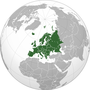
A graticule (from Latin crāticula 'grill/grating'), on a map, is a graphical depiction of a coordinate system as a grid of lines, each line representing a constant coordinate value.[1] It is thus a form of isoline, and is commonly found on maps of many kinds, at scales from local to global.
The term is almost always used to specifically refer to the parallels and meridians of latitude and longitude respectively in the geographic coordinate system. In modern usage, graticules are contrasted with grids, which display the eastings and northings of another coordinate reference system, such as Universal Transverse Mercator – usually the coordinate system in which the map is drawn.[2]
Some cartographers have used the term "graticule" to refer not only to the visual lines, but to the system of latitude and longitude reference itself;[3] however, in the era of geographic information systems, it is more accurate to call this the geographic coordinate system.
- ^ Robinson, Arthur H.; Morrison, Joel L.; Muehrcke, Phillip C.; Kimerling, A. Jon; Guptill, Stephen C. (1995). Elements of Cartography (6th ed.). Wiley. p. 48.
- ^ "Grids and graticules—ArcGIS Pro | Documentation". pro.arcgis.com. Retrieved 2024-01-27.
- ^ Dent, Borden D., Jeffrey S. Torguson, Thomas W. Hodler, Cartography: Thematic Map Design, 6th Edition, McGraw-Hill, 2009, p.27
