KML is from Wikidata
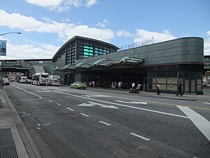
 Roosevelt Avenue Bus Terminal in Jackson Heights | |
| Namesake | Greenpoint Bluff Theodore and Franklin D. Roosevelt |
|---|---|
| Owner | City of New York |
| Maintained by | NYCDOT |
| Length | 8.3 mi (13.4 km)[1] 2.4 mi (3.86 km) as Greenpoint Avenue 5.9 mi (9.50 km) as Roosevelt Avenue |
| Location | Brooklyn, Queens |
| Postal code | 11222, 11101, 11104, 11377, 11372, 11373, 11368, 11354 |
| Nearest metro station | Greenpoint Avenue Flushing Line Roosevelt/74th |
| West end | West Street in Greenpoint |
| Major junctions | |
| East end | |
Roosevelt Avenue and Greenpoint Avenue are main thoroughfares in the New York City boroughs of Queens and Brooklyn. Roosevelt Avenue begins at 48th Street and Queens Boulevard in the neighborhood of Sunnyside. West of Queens Boulevard, the road is named Greenpoint Avenue and continues through Sunnyside and Long Island City across the Greenpoint Avenue Bridge into the borough of Brooklyn, terminating at WNYC Transmitter Park on the East River in the neighborhood of Greenpoint.[2] Roosevelt Avenue goes through Woodside, Jackson Heights, Elmhurst, Corona, Flushing Meadows–Corona Park (adjacent to Citi Field) and Flushing. In Flushing, Roosevelt Avenue ends at 156th Street and Northern Boulevard.[1]
- ^ a b "Greenpoint and Roosevelt Avenues" (Map). Google Maps. Retrieved January 9, 2017.
- ^ "NYCDOT - Greenpoint Avenue Bridge over Newtown Creek". Archived from the original on 2010-02-21. Retrieved 2008-11-10.
