Back مقاطعة غوينيت (جورجيا) Arabic Gwinnett County, Georgia BAR Гуинет (окръг, Джорджия) Bulgarian গৱিন্নেট কাউন্টি, জর্জিয়া BPY Gwinnett Gông (Georgia) CDO Гуиннетт (гуо, Джорджи) CE Gwinnett County CEB Gwinnett County, Georgia Welsh Gwinnett County German Kantono Gwinnett (Georgio) Esperanto
Gwinnett County | |
|---|---|
 | |
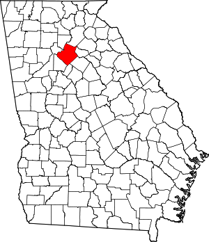
 Location within the U.S. state of Georgia | |
 Georgia's location within the U.S. | |
| Coordinates: 33°58′N 84°02′W / 33.96°N 84.03°W | |
| Country | |
| State | |
| Founded | December 15, 1818 |
| Named for | Button Gwinnett |
| Seat | Lawrenceville |
| Largest city | Peachtree Corners |
| Area | |
• Total | 437 sq mi (1,130 km2) |
| • Land | 430 sq mi (1,100 km2) |
| • Water | 6.4 sq mi (17 km2) 1.5% |
| Population (2020) | |
• Total | 942,627[1] |
• Estimate (2023) | 983,526 |
| • Density | 2,123/sq mi (820/km2) |
| Time zone | UTC−5 (Eastern) |
| • Summer (DST) | UTC−4 (EDT) |
| Congressional districts | 4th, 9th, 10th, 13th |
| Website | gwinnettcounty.com |
Gwinnett County (/ɡwɪˈnɛt/ gwih-NEHT) is located in the north central portion of the U.S. state of Georgia.[2] It forms part of the Atlanta metropolitan area, being located about 9 miles (14 km) northeast of Atlanta city limits. In 2020, the population was 957,062, making it the second-most populous county in Georgia (after Fulton County).[1] Its county seat is Lawrenceville.[3] The county is named for Button Gwinnett, one of the signatories of the Declaration of Independence.[4]
Gwinnett County is the most ethnically-diverse county in Georgia,[5][6][7] with significant populations of Black, Hispanic, and Asian residents. As of the 2020 Census, no ethnicity constitutes more than a third of its population.[8]
- ^ a b "Population estimates, July 1, 2018, (V2018)". Census.gov. Archived from the original on June 22, 2019. Retrieved June 22, 2019.
- ^ "About Gwinnett". Gwinnettcounty.com. Archived from the original on July 1, 2017. Retrieved May 26, 2017.
- ^ "City of Lawrenceville, Georgia - Home Page". Lawrencevillega.org. Archived from the original on June 23, 2011. Retrieved June 29, 2016.
- ^ Gannett, Henry (1905). The Origin of Certain Place Names in the United States. Govt. Print. Off. pp. 146.
- ^ Journal, Matt Vasilogambros, National (April 2, 2015). "The Most Diverse County in the Southeast Is Run Almost Entirely by White Politicians". The Atlantic. Retrieved November 24, 2023.
{{cite web}}: CS1 maint: multiple names: authors list (link) - ^ "Most diverse counties in Georgia". Stacker. Retrieved November 24, 2023.
- ^ "2023 Most Diverse Counties in Georgia". Niche. Retrieved November 24, 2023.
- ^ "Explore Census Data". data.census.gov. Retrieved November 24, 2023.


