Back هادونفيلد (نيوجيرسي) Arabic Haddonfield AST هادونفیلد، نیوجرسی AZB Haddonfield Catalan Гаддонфилд (Нью-Джерси) CE Haddonfield CEB Haddonfield, New Jersey Welsh Haddonfield DAG Haddonfield German Haddonfield Spanish
Haddonfield, New Jersey | |
|---|---|
 Downtown Haddonfield in March 2005 | |
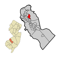
 Location of Haddonfield in Camden County highlighted in red (right). Inset map: Location of Camden County in New Jersey highlighted in orange (left). | |
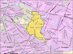
 Census Bureau map of Haddonfield, New Jersey | |
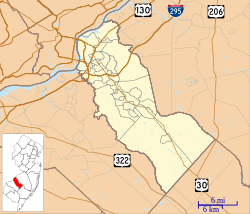
Location in Camden County Location in New Jersey | |
| Coordinates: 39°53′43″N 75°02′04″W / 39.895416°N 75.034413°W[1][2] | |
| Country | |
| State | |
| County | Camden |
| Incorporated | April 6, 1875 |
| Named for | Elizabeth Haddon |
| Government | |
| • Type | Walsh Act |
| • Body | Board of Commissioners |
| • Mayor | Colleen Bianco Bezich (term ends May 19, 2025)[3][4] |
| • Administrator | Sharon McCullough[5] |
| • Municipal clerk | Deanna Bennett[6] |
| Area | |
• Total | 2.84 sq mi (7.36 km2) |
| • Land | 2.80 sq mi (7.24 km2) |
| • Water | 0.04 sq mi (0.12 km2) 1.58% |
| • Rank | 350th of 565 in state 13th of 37 in county[1] |
| Elevation | 75 ft (23 m) |
| Population | |
• Total | 12,550 |
| 12,571 | |
| • Rank | 204th of 565 in state 10th of 37 in county[13] |
| • Density | 4,488.6/sq mi (1,733.1/km2) |
| • Rank | 133rd of 565 in state 13th of 37 in county[13] |
| Time zone | UTC−05:00 (Eastern (EST)) |
| • Summer (DST) | UTC−04:00 (Eastern (EDT)) |
| ZIP Code | |
| Area code | 856[16] |
| FIPS code | 3400728770[1][17][18] |
| GNIS feature ID | 0885238[1][19] |
| Website | www |
Haddonfield is a borough located in Camden County, in the U.S. state of New Jersey. As of the 2020 United States census, the borough's population was 12,550,[10][11] an increase of 957 (+8.3%) from the 2010 census count of 11,593,[20][21] which in turn reflected a decline of 66 (−0.6%) from the 11,659 counted in the 2000 census[22]
Haddonfield was incorporated by an act of the New Jersey Legislature on April 6, 1875, within portions of Haddon Township following a referendum on the same day. The borough became an independent municipality in 1894.[23] The borough was named for Elizabeth Haddon, an early settler of the area.[24][25]
- ^ a b c d 2019 Census Gazetteer Files: New Jersey Places, United States Census Bureau. Accessed July 1, 2020.
- ^ US Gazetteer files: 2010, 2000, and 1990, United States Census Bureau. Accessed September 4, 2014.
- ^ Cite error: The named reference
Commissionwas invoked but never defined (see the help page). - ^ 2023 New Jersey Mayors Directory, New Jersey Department of Community Affairs, updated February 8, 2023. Accessed February 10, 2023.
- ^ Borough Administrator, Borough of Haddonfield. Accessed April 20, 2023.
- ^ Borough Clerk, Borough of Haddonfield. Accessed April 20, 2023.
- ^ Cite error: The named reference
DataBookwas invoked but never defined (see the help page). - ^ "ArcGIS REST Services Directory". United States Census Bureau. Retrieved October 11, 2022.
- ^ U.S. Geological Survey Geographic Names Information System: Borough of Haddonfield, Geographic Names Information System. Accessed March 5, 2013.
- ^ a b c Cite error: The named reference
Census2020was invoked but never defined (see the help page). - ^ a b Cite error: The named reference
LWD2020was invoked but never defined (see the help page). - ^ Cite error: The named reference
PopEstwas invoked but never defined (see the help page). - ^ a b Population Density by County and Municipality: New Jersey, 2020 and 2021, New Jersey Department of Labor and Workforce Development. Accessed March 1, 2023.
- ^ Look Up a ZIP Code, United States Postal Service. Accessed November 24, 2011.
- ^ Zip Codes, State of New Jersey. Accessed September 22, 2013.
- ^ Area Code Lookup - NPA NXX for Haddonfield, NJ, Area-Codes.com. Accessed September 22, 2013.
- ^ U.S. Census website, United States Census Bureau. Accessed September 4, 2014.
- ^ Geographic Codes Lookup for New Jersey, Missouri Census Data Center. Accessed April 1, 2022.
- ^ US Board on Geographic Names, United States Geological Survey. Accessed September 4, 2014.
- ^ Cite error: The named reference
Census2010was invoked but never defined (see the help page). - ^ Cite error: The named reference
LWD2010was invoked but never defined (see the help page). - ^ Table 7. Population for the Counties and Municipalities in New Jersey: 1990, 2000 and 2010, New Jersey Department of Labor and Workforce Development, February 2011. Accessed May 1, 2023.
- ^ Snyder, John P. The Story of New Jersey's Civil Boundaries: 1606-1968, Bureau of Geology and Topography; Trenton, New Jersey; 1969. p. 106. Accessed April 26, 2012.
- ^ Hutchinson, Viola L. The Origin of New Jersey Place Names, New Jersey Public Library Commission, May 1945. Accessed August 31, 2015.
- ^ Gannett, Henry. The Origin of Certain Place Names in the United States, p. 146. United States Government Printing Office, 1905. Accessed August 31, 2015.


