Back هاله (بلجيكا) Arabic Хале (Белгия) Bulgarian Halle (Brabant Flandrez) Breton Halle (Bèlgica) Catalan Halle (parokya sa Belhika, Flanders, Provincie Vlaams-Brabant, lat 50,73, long 4,23) CEB Halle (Belgie) Czech Halle (Belgien) Danish Halle (Belgien) German Halle (Flandra Brabanto) Esperanto Halle (Bélgica) Spanish
Halle
Hal (French) | |
|---|---|
City and municipality | |
 The Grote Markt | |
| Coordinates: 50°44′10″N 04°14′14″E / 50.73611°N 4.23722°E | |
| Country | |
| Community | Flemish Community |
| Region | Flemish Region |
| Province | Flemish Brabant |
| Arrondissement | Halle-Vilvoorde |
| Government | |
| • Mayor | Eva Demesmaeker (N-VA) |
| • Governing party/ies | N-VA, CD&V |
| Area | |
• Total | 44.98 km2 (17.37 sq mi) |
| Population (2018-01-01)[1] | |
• Total | 39,096 |
| • Density | 870/km2 (2,300/sq mi) |
| Postal codes | 1500, 1501, 1502 |
| NIS code | 23027 |
| Area codes | 02 |
| Website | www.halle.be |
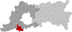
Halle (Dutch pronunciation: [ˈɦɑlə] ⓘ; French: Hal, pronounced [al]) is a Belgian city and municipality in the Halle-Vilvoorde district (arrondissement) of the province of Flemish Brabant. It is located on the Brussels–Charleroi Canal and on the Flemish side of the language border that separates Flanders and Wallonia. Halle lies on the border between the Flemish plains to the North (thick loam) and the undulating Brabant lands to the South (thinner loam). The city also borders on the Pajottenland to the west. It is about 22 km (14 mi) southwest of Brussels. The official language of Halle is Dutch, as in the rest of Flanders.
The municipality comprises the city of Halle proper and the towns of Buizingen and Lembeek. The neighboring towns are: Pepingen, Sint-Pieters-Leeuw, Beersel, Braine-l'Alleud, Braine-le-Château, and Tubize. The population of Halle has increased from 32,758 inhabitants in 1991 to 39,536 on 1 January 2019. The mayor is Eva Demesmaeker of the N-VA party.
- ^ "Wettelijke Bevolking per gemeente op 1 januari 2018". Statbel. Retrieved 9 March 2019.


