Back هاموند (لويزيانا) Arabic هاموند (تانجيباهوا) ARZ همند، لوئیزیانا AZB Hammond (Louisiana) Catalan Гаммонд (Луизиана) CE Hammond (lungsod sa Tinipong Bansa, Louisiana) CEB Hammond, Louisiana Welsh Hammond (Louisiana) German Hammond (Luiziano) Esperanto Hammond (Luisiana) Spanish
Hammond, Louisiana | |
|---|---|
 The Hammond Oak, located in the 500 block of East Charles Street: The grave of founder Peter av Hammerdal (Peter Hammond) is under this tree, along with the graves of several family members and enslaved people. | |
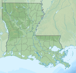
 Location of Hammond in Tangipahoa Parish, Louisiana | |
| Coordinates: 30°30′09″N 90°28′30″W / 30.50250°N 90.47500°W[1] | |
| Country | |
| State | |
| Parish | Tangipahoa |
| Settled | 1818 |
| Chartered | 1889[2] |
| Government | |
| • Mayor | Pete Panepinto[3] |
| Area | |
• Total | 14.25 sq mi (36.92 km2) |
| • Land | 14.25 sq mi (36.91 km2) |
| • Water | 0.00 sq mi (0.01 km2) |
| Elevation | 39 ft (12 m) |
| Population (2020) | |
• Total | 19,584 |
| • Density | 1,374.22/sq mi (530.59/km2) |
| Time zone | UTC−6 (CST) |
| • Summer (DST) | UTC−5 (CDT) |
| ZIP code | 70401, 70403 |
| Area code | 985 |
| FIPS code | 22-32755 |
| GNIS feature ID | 2403788[1] |
| Website | www.hammond.org |
Hammond is the largest city in Tangipahoa Parish, Louisiana, United States, located 45 miles (72 km) east of Baton Rouge and 45 miles (72 km) northwest of New Orleans. Its population was 20,019 in the 2010 U.S. census, and 21,359 at the 2020 population estimates program.[5]
Hammond is home to Southeastern Louisiana University. It is the principal city of the Hammond metropolitan statistical area, which includes all of Tangipahoa Parish and is a part of the Baton Rouge-Hammond combined statistical area.[6]
- ^ a b c U.S. Geological Survey Geographic Names Information System: Hammond, Louisiana
- ^ Hammond Historic District's home page Archived 2015-09-26 at the Wayback Machine. Accessed 25 July 2017.
- ^ Mayor's Biography, City of Hammond Website, Accessed: September 22, 2024
- ^ "2020 U.S. Gazetteer Files". United States Census Bureau. Archived from the original on April 19, 2022. Retrieved March 20, 2022.
- ^ "City and Town Population Totals: 2010-2020". The United States Census Bureau. Archived from the original on June 26, 2021. Retrieved July 23, 2021.
- ^ Van Leuven, Andrew J. (August 4, 2023). "Recent Changes to U.S. Metropolitan and Micropolitan Areas". Andrew J. Van Leuven, Ph.D. Retrieved January 11, 2024.

