Hato Rey | |
|---|---|
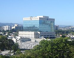
 RG Financial Corporation headquarters in Hato Rey | |
 Location of Hato Rey shown in yellow within San Juan | |
 | |
| Coordinates: 18°25′25″N 66°03′27″W / 18.4235°N 66.0576°W | |
| Commonwealth | Puerto Rico |
| Municipality | San Juan |
| Area | |
• Total | 6.18 sq mi (16.01 km2) |
| • Land | 5.38 sq mi (13.93 km2) |
| • Water | 0.80 sq mi (2.07 km2) |
| Population (2000) | |
• Total | 48,196 |
| • Density | 8,958.36/sq mi (3,458.84/km2) |
| 2000 census | |
| ZIP Code | 00917, 00919 |
Hato Rey (Spanish for ''king’s cattle farm''), often considered the central business district of Puerto Rico, is an urbanized financial, commercial, and residential district in San Juan, the capital municipality of the archipelago and island. Located at the center of the main metropolitan area and divided into the three barrios of Hato Rey Norte, Hato Rey Central and Hato Rey Sur, it is about 3 to 6 miles (4.8 to 9.7 km) from the Old San Juan historic quarter, Condado and Isla Verde resort areas, and SJU airport. Hato Rey is home to the Milla de Oro financial district, José Miguel Agrelot Coliseum, Hiram Bithrom Stadium, Telumundo International television network headquarters, and Plaza Las Américas shopping mall, among others. It was formerly a barrio of the dissolved municipality of Río Piedras, which was merged with San Juan in 1951.

