Herdla Municipality
Herdla herad | |
|---|---|
| Herlø herred (historic name) | |
 Aerial view of the island | |
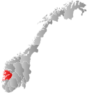
 Hordaland within Norway | |
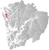
 Herdla within Hordaland | |
| Coordinates: 60°34′24″N 04°56′51″E / 60.57333°N 4.94750°E | |
| Country | Norway |
| County | Hordaland |
| District | Nordhordland |
| Established | 1 Jan 1871 |
| • Preceded by | Manger Municipality |
| Disestablished | 1 Jan 1964 |
| • Succeeded by | Askøy, Fjell, Meland, Radøy, and Øygarden municipalities |
| Administrative centre | Herdla |
| Area (upon dissolution) | |
• Total | 115 km2 (44 sq mi) |
| Population (1963) | |
• Total | 4,991 |
| • Density | 43/km2 (110/sq mi) |
| Time zone | UTC+01:00 (CET) |
| • Summer (DST) | UTC+02:00 (CEST) |
| ISO 3166 code | NO-1258[1] |
Herdla is a former municipality in the old Hordaland county in Norway. The municipality existed from 1871 until its dissolution in 1964. The municipality encompassed a large group of about 2,000 islands and skerries covering about 115-square-kilometre (44 sq mi) of land area, to the northwest of the city of Bergen in what is now parts of Øygarden, Alver, and Askøy municipalities in Vestland county. The administrative centre of the municipality was the small island-village of Herdla. The municipality included the northern third of the island of Holsnøy, the northern third of the island of Askøy, and the islands of Misje, Turøy, Toftøy, Rongøy, Blomøy, Ona, Bognøy, and many smaller surrounding islands.[2]
- ^ Bolstad, Erik; Thorsnæs, Geir, eds. (9 January 2024). "Kommunenummer". Store norske leksikon (in Norwegian). Foreningen Store norske leksikon.
- ^ Store norske leksikon. "Herdla. – tidl. kommune i Hordaland" (in Norwegian). Retrieved 17 April 2014.
