Back Dějiny Saskatchewanu Czech Saskatchewan#Geschichte German Սասկաչևանի պատմություն Armenian Historia Saskatchewanu Polish История Саскачевана Russian 薩斯喀徹溫省歷史 Chinese


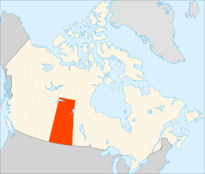
History of Saskatchewan encompasses the study of past human events and activities of the Canadian province of Saskatchewan, the middle of Canada's three prairie provinces. Archaeological studies give some clues as to the history and lifestyles of the Palaeo-Indian, Taltheilei, and Shield Archaic traditions who were the first occupants of the prehistoric era of this geographical area. They evolved into the history of the First Nations people who kept their history alive in oral tradition. The First Nation bands that were a part of this area were the Chipewyan, Cree, Saulteaux, Assiniboine, Atsina, and Sioux.[3]
Henry Kelsey (1667–1724), was the first European (an Englishman) to visit this area, and arrived in 1690.[4] Other European explorers also soon arrived followed by fur traders such as the Governor and Company of Adventurers of England trading into Hudson's Bay (Hudson's Bay Company) and North West Company. Clifford Sifton, Minister of the Interior in charge of immigration, (1896–1905) induced a variety of agriculturally inclined European emigrants to Canada to settle prairie land around the transcontinental railway. The political boundaries of this area have changed several times evolving through Rupert's Land, Provisional Districts of the North-West Territories, and finally a province. Saskatchewan has been a province of Canada since 1905.
- ^ Fung, Professor of Geography, University of Saskatchewan., Dr. K.I.; RICHARDS, J. Howard. "Evolution-boundaries-1882: (1969). Atlas of Saskatchewan. Saskatoon: Modern Press". Retrieved 2007-10-12.
{{cite web}}: CS1 maint: multiple names: authors list (link) - ^ "The Atlas of Canada – Territorial Evolution, 1895". Archived from the original on 2007-10-10. Retrieved 2007-10-12.
- ^ Sask Gen Web SGW First Nations Saskatchewan Genealogy Roots, URL accessed 26 November 2006
- ^ Saskatchewan Gen Web Project – SGW – Canadian Migrations Saskatchewan Genealogy Roots URL accessed April 12, 2007