Back هوغو (مينيسوتا) Arabic هوجو (واشنطن) ARZ هیوقو، مینهسوتا AZB Hugo (Minnesota) Catalan Гьюго (Миннесота) CE Hugo (lungsod) CEB Hugo (Minnesota) German Hugo (Minnesota) Spanish Hugo (Minnesota) Basque هیوگو، مینهسوتا Persian
Hugo | |
|---|---|
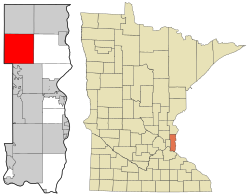
 Location of the city of Hugo within Washington County, Minnesota | |
| Coordinates: 45°9′8″N 92°57′48″W / 45.15222°N 92.96333°W | |
| Country | United States |
| State | Minnesota |
| County | Washington |
| Government | |
| • Mayor | Tom Weidt[1] |
| Area | |
• Total | 36.03 sq mi (93.33 km2) |
| • Land | 33.46 sq mi (86.66 km2) |
| • Water | 2.57 sq mi (6.67 km2) |
| Elevation | 929 ft (283 m) |
| Population (2020) | |
• Total | 15,766 |
| • Density | 471.18/sq mi (181.92/km2) |
| Time zone | UTC-6 (Central (CST)) |
| • Summer (DST) | UTC-5 (CDT) |
| ZIP code | 55038 |
| Area code | 651 |
| FIPS code | 27-30392[4] |
| GNIS feature ID | 2394440[3] |
| Website | City of Hugo |


Hugo (/ˈhjuːɡoʊ/ HEW-goh) is a city 18 miles (29 km) north of downtown Saint Paul in Washington County in the U.S. state of Minnesota. The population was 14,767 at the 2020 census.[5] The city lies north of White Bear Lake on the border of the metropolitan boundary. Hugo and nearby suburbs comprise the northeast portion of Minneapolis-St. Paul, the sixteenth largest metropolitan area in the United States.
The city's largest lake, Oneka Lake, is named for the Dakota word "onakan," which means "to strike or knock off," rice into a canoe. Just south is Rice Lake where Mdewakanton Dakota from Mendota gathered wild rice.
- ^ "Mayor and Council". City of Hugo, MN. Retrieved February 4, 2018.
- ^ "2020 U.S. Gazetteer Files". United States Census Bureau. Retrieved July 24, 2022.
- ^ a b U.S. Geological Survey Geographic Names Information System: Hugo, Minnesota
- ^ "U.S. Census website". United States Census Bureau. Retrieved January 31, 2008.
- ^ "2010 Census Redistricting Data (Public Law 94-171) Summary File". American FactFinder. U.S. Census Bureau, 2010 Census. Retrieved April 23, 2011.[dead link]