Back إيغاركا Arabic ایقارکا AZB Ігарка Byelorussian Игарка Bulgarian Igarka Catalan Игарка CE Igarka (lungsod) CEB İgarka CRH Igarka Czech Igarka German
Igarka
Игарка | |
|---|---|
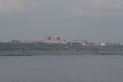
 Igaraka from the Yenesei River | |
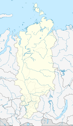
| Coordinates: 67°28′N 86°35′E / 67.467°N 86.583°E | |
| Country | Russia |
| Federal subject | Krasnoyarsk Krai[1] |
| Administrative district | Turukhansky District[1] |
| District town | Igarka[1] |
| Founded | 1929 |
| Town status since | 1931 |
| Elevation | 20 m (70 ft) |
| Population | |
• Total | 6,183 |
| • Capital of | District town of Igarka[1] |
| • Municipal district | Turukhansky Municipal District[3] |
| • Urban settlement | Igarka Urban Settlement[3] |
| • Capital of | Igarka Urban Settlement[3] |
| Time zone | UTC+7 (MSK+4 |
| Postal code(s)[5] | |
| OKTMO ID | 04654117001 |
| Website | igarkacity |
Preview warning: Page using Template:Infobox Russian inhabited locality with unknown parameter "1 = lats
"
Preview warning: Page using Template:Infobox Russian inhabited locality with unknown parameter "2 = longs
"
Preview warning: Page using Template:Infobox Russian inhabited locality with unknown parameter "3 = flag_caption
"
Preview warning: Page using Template:Infobox Russian inhabited locality with unknown parameter "4 = coa_caption
"
Preview warning: Page using Template:Infobox Russian inhabited locality with unknown parameter "5 = anthem
"
Preview warning: Page using Template:Infobox Russian inhabited locality with unknown parameter "6 = anthem_ref
"
Preview warning: Page using Template:Infobox Russian inhabited locality with unknown parameter "7 = holiday
"
Preview warning: Page using Template:Infobox Russian inhabited locality with unknown parameter "8 = holiday_ref
"
Preview warning: Page using Template:Infobox Russian inhabited locality with unknown parameter "9 = leader_title
"
Preview warning: Page using Template:Infobox Russian inhabited locality with unknown parameter "10 = leader_title_ref
"
Preview warning: Page using Template:Infobox Russian inhabited locality with unknown parameter "11 = leader_name
"
Preview warning: Page using Template:Infobox Russian inhabited locality with unknown parameter "12 = leader_name_ref
"
Preview warning: Page using Template:Infobox Russian inhabited locality with unknown parameter "13 = representative_body
"
Preview warning: Page using Template:Infobox Russian inhabited locality with unknown parameter "14 = representative_body_ref
"
Preview warning: Page using Template:Infobox Russian inhabited locality with unknown parameter "15 = area_of_what
"
Preview warning: Page using Template:Infobox Russian inhabited locality with unknown parameter "16 = area_as_of
"
Preview warning: Page using Template:Infobox Russian inhabited locality with unknown parameter "17 = area_km2
"
Preview warning: Page using Template:Infobox Russian inhabited locality with unknown parameter "18 = area_km2_ref
"
Preview warning: Page using Template:Infobox Russian inhabited locality with unknown parameter "19 = pop_density
"
Preview warning: Page using Template:Infobox Russian inhabited locality with unknown parameter "20 = pop_density_as_of
"
Preview warning: Page using Template:Infobox Russian inhabited locality with unknown parameter "21 = pop_density_ref
"
Preview warning: Page using Template:Infobox Russian inhabited locality with unknown parameter "22 = pop_latest
"
Preview warning: Page using Template:Infobox Russian inhabited locality with unknown parameter "23 = pop_latest_date
"
Preview warning: Page using Template:Infobox Russian inhabited locality with unknown parameter "24 = pop_latest_ref
"
Preview warning: Page using Template:Infobox Russian inhabited locality with unknown parameter "25 = established_title
"
Preview warning: Page using Template:Infobox Russian inhabited locality with unknown parameter "26 = established_date_ref
"
Preview warning: Page using Template:Infobox Russian inhabited locality with unknown parameter "27 = current_cat_date_ref
"
Preview warning: Page using Template:Infobox Russian inhabited locality with unknown parameter "28 = prev_name1
"
Preview warning: Page using Template:Infobox Russian inhabited locality with unknown parameter "29 = prev_name1_date
"
Preview warning: Page using Template:Infobox Russian inhabited locality with unknown parameter "30 = prev_name1_ref
"
Preview warning: Page using Template:Infobox Russian inhabited locality with unknown parameter "31 = postal_codes
"
Preview warning: Page using Template:Infobox Russian inhabited locality with unknown parameter "32 = postal_codes_ref
"
Preview warning: Page using Template:Infobox Russian inhabited locality with unknown parameter "33 = dialing_codes
"
Preview warning: Page using Template:Infobox Russian inhabited locality with unknown parameter "34 = dialing_codes_ref
"
Preview warning: Page using Template:Infobox Russian inhabited locality with unknown parameter "35 = website_ref
"
Preview warning: Page using Template:Infobox Russian inhabited locality with unknown parameter "date"
Preview warning: Page using Template:Infobox Russian inhabited locality with unknown parameter "adm_data_as_of"
Preview warning: Page using Template:Infobox Russian inhabited locality with unknown parameter "mun_data_as_of"
Igarka (Russian: Ига́рка) is a town in Turukhansky District of Krasnoyarsk Krai, Russia, located 163 kilometers (101 mi) north of the Arctic Circle. Igarka is a monotown established around a sawmill which processed timber logged in the basin of the Yenisei River for export. Up to 1956, it was largely inhabited by deportees and political prisoners.[6] Since the dissolution of the Soviet Union in 1991, the town's population has rapidly declined – it decreased from 18,820 (1989 Soviet census)[7] to 4,417 (2019).[6]
- ^ a b c d e Cite error: The named reference
KrasnoyarskK_admlistwas invoked but never defined (see the help page). - ^ Cite error: The named reference
2010Censuswas invoked but never defined (see the help page). - ^ a b c Cite error: The named reference
KrasnoyarskKTurukhanskyD_munwas invoked but never defined (see the help page). - ^ "Об исчислении времени". Официальный интернет-портал правовой информации (in Russian). June 3, 2011. Retrieved January 19, 2019.
- ^ Почта России. Информационно-вычислительный центр ОАСУ РПО. (Russian Post). Поиск объектов почтовой связи (Postal Objects Search) (in Russian)
- ^ a b Cite error: The named reference
vlewas invoked but never defined (see the help page). - ^ Всесоюзная перепись населения 1989 г. Численность наличного населения союзных и автономных республик, автономных областей и округов, краёв, областей, районов, городских поселений и сёл-райцентров [All Union Population Census of 1989: Present Population of Union and Autonomous Republics, Autonomous Oblasts and Okrugs, Krais, Oblasts, Districts, Urban Settlements, and Villages Serving as District Administrative Centers]. Всесоюзная перепись населения 1989 года [All-Union Population Census of 1989] (in Russian). Институт демографии Национального исследовательского университета: Высшая школа экономики [Institute of Demography at the National Research University: Higher School of Economics]. 1989 – via Demoscope Weekly.


