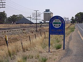
| Illabo New South Wales | |
|---|---|
 Entering Illabo | |
| Coordinates | 34°49′0″S 147°45′0″E / 34.81667°S 147.75000°E |
| Population | 144 (2016 census)[1] |
| Postcode(s) | 2590 |
| Elevation | 279 m (915 ft) |
| Location |
|
| LGA(s) | Junee Shire |
| County | Clarendon |
| State electorate(s) | Cootamundra |
| Federal division(s) | Riverina |
Illabo (pron. ILL a boh) is a locality in the South West Slopes part of the Riverina in New South Wales, Australia. It is situated about 13 kilometres (8 mi) southwest of Bethungra and 16 kilometres (10 mi) northeast of Junee. At the 2016 census, Illabo had a population of 144.[1][2]
- ^ a b Australian Bureau of Statistics (27 June 2017). "Illabo (State Suburb)". 2016 Census QuickStats. Retrieved 26 August 2019.
- ^ "Illabo". Geographical Names Register (GNR) of NSW. Geographical Names Board of New South Wales. Retrieved 26 August 2019.

