| Iloilo Strait | |
|---|---|
 | |
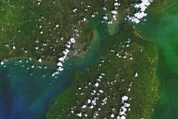
 NASA satellite image taken before May 2007 | |
| Location | Western Visayas |
| Coordinates | 10°41′07″N 122°35′21″E / 10.685209°N 122.589194°E |
| Type | strait |
| Etymology | Iloilo |
| Part of | Sulu Sea |
| Max. length | 25 km (16 mi), NE-SW |
| Settlements | Iloilo City |
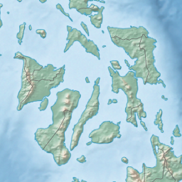
The Iloilo Strait is a strait in the Philippines that separates the islands of Panay and Guimaras in the Visayas, and connects Panay Gulf with the Guimaras Strait. It is the location of the Port of Iloilo, the third-busiest of the ports in the Philippines in number of ships.[1] Iloilo City on Panay is the major city located on the strait with Buenavista and Jordan, both on Guimaras, immediately across the strait from the city. The Iloilo River empties into the strait.
Pump boat ferries cross every few minutes from Iloilo City to Guimaras and vice versa. Ships doing business with the Port of Iloilo often moor in the strait.
- ^ "PMO ILOILO". Philippine Ports Authority. Archived from the original on 28 October 2013. Retrieved 15 July 2013.


