Back Indre Fosen Danish Indre Fosen German Indre Fosen Esperanto Indre Fosen Finnish Indre Fosen French Indre Fosen (sveitarfélag) Icelandic Indre Fosen Italian Indre Fosen Dutch Indre Fosen kommune NN Indre Fosen NB
Indre Fosen Municipality
Indre Fosen kommune | |
|---|---|
 View of the Rissa Church | |
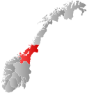
 Trøndelag within Norway | |
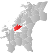
 Indre Fosen within Trøndelag | |
| Coordinates: 63°38′38″N 10°11′13″E / 63.64382°N 10.18707°E | |
| Country | Norway |
| County | Trøndelag |
| District | Fosen |
| Established | 1 Jan 2018 |
| • Preceded by | Rissa Municipality and Leksvik Municipality |
| Administrative centre | Årnset |
| Government | |
| • Mayor (2023) | Oskar Småvik (H) |
| Area | |
• Total | 1,095.97 km2 (423.16 sq mi) |
| • Land | 1,030.41 km2 (397.84 sq mi) |
| • Water | 65.56 km2 (25.31 sq mi) 6% |
| • Rank | #102 in Norway |
| Highest elevation | 622.5 m (2,042.3 ft) |
| Population (2024) | |
• Total | 10,023 |
| • Rank | #113 in Norway |
| • Density | 9.1/km2 (24/sq mi) |
| • Change (10 years) | |
| Demonym | Indre Fosning[2] |
| Official language | |
| • Norwegian form | Neutral |
| Time zone | UTC+01:00 (CET) |
| • Summer (DST) | UTC+02:00 (CEST) |
| ISO 3166 code | NO-5054[4] |
| Website | Official website |
Indre Fosen is a municipality in Trøndelag county, Norway. It is located in the traditional district of Fosen. The administrative centre of the municipality is the village of Årnset. Other villages in Indre Fosen include Askjem, Dalbygda, Hasselvika, Husbysjøen, Leira, Leksvik, Råkvåg, Rørvika, Seter, Stadsbygd, Sørfjorden, Verrabotn, and Vanvikan. The Norwegian County Road 755 runs through the municipality.
The 1,096-square-kilometre (423 sq mi) municipality is the 102nd largest by area out of the 357 municipalities in Norway. Indre Fosen Municipality is the 113th most populous municipality in Norway with a population of 10,023. The municipality's population density is 9.1 inhabitants per square kilometre (24/sq mi) and its population has decreased by 1.7% over the previous 10-year period.[5][6]
Economy: in January 2024, a shipyard that employed 132, went bankrupt.[7]
- ^ "Høgaste fjelltopp i kvar kommune" (in Norwegian). Kartverket. 16 January 2024.
- ^ "Navn på steder og personer: Innbyggjarnamn" (in Norwegian). Språkrådet.
- ^ "Forskrift om målvedtak i kommunar og fylkeskommunar" (in Norwegian). Lovdata.no.
- ^ Bolstad, Erik; Thorsnæs, Geir, eds. (9 January 2024). "Kommunenummer". Store norske leksikon (in Norwegian). Foreningen Store norske leksikon.
- ^ Statistisk sentralbyrå. "Table: 06913: Population 1 January and population changes during the calendar year (M)" (in Norwegian).
- ^ Statistisk sentralbyrå. "09280: Area of land and fresh water (km²) (M)" (in Norwegian).
- ^ https://e24.no/naeringsliv/i/xgLx18/fosen-yard-med-132-ansatte-konkurs-tung-dag?referer=https%3A%2F%2Fwww.vg.no. E24.no. Retrieved 2024-01-30

