Back ایپسویچ، ماساچوست AZB Ipswich (Massachusetts) Catalan Ипсвич (Массачусетс) CE Ipswich (lungsod sa Tinipong Bansa, Massachusetts) CEB Ipswich, Massachusetts Welsh Ipswich DAG Ipswich (Massachusetts) German Ipswich (Massachusetts) Spanish Ipswich (Massachusetts) Basque ایپسویچ، ماساچوست Persian
Ipswich, Massachusetts | |
|---|---|
| Town of Ipswich | |
 John Whipple House, constructed c. 1677 | |
| Nickname: Birthplace of American Independence | |
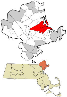
 Location in Essex County and the state of Massachusetts. | |
| Coordinates: 42°40′45″N 70°50′30″W / 42.67917°N 70.84167°W | |
| Country | United States |
| State | Massachusetts |
| County | Essex |
| Settled | 1633 |
| Incorporated | August 5, 1634 |
| Founded by | John Winthrop the Younger |
| Named for | Ipswich, England |
| Government | |
| • Type | Open town meeting |
| Area | |
• Total | 42.5 sq mi (110.1 km2) |
| • Land | 32.1 sq mi (83.2 km2) |
| • Water | 10.4 sq mi (26.9 km2) |
| Elevation | 50 ft (15 m) |
| Population (2020) | |
• Total | 13,785 |
| • Density | 320/sq mi (130/km2) |
| Time zone | UTC−5 (Eastern) |
| • Summer (DST) | UTC−4 (Eastern) |
| ZIP Code | 01938 |
| Area code | 351/356/978 |
| FIPS code | 25-32310 |
| GNIS feature ID | 0619448 |
| Website | ipswichma.gov |
Ipswich is a coastal town in Essex County, Massachusetts, United States. The population was 13,785 at the 2020 census.[1] Home to Willowdale State Forest and Sandy Point State Reservation, Ipswich includes the southern part of Plum Island. A residential community with a vibrant tourism industry, the town is famous for its clams, celebrated annually at the Ipswich Chowderfest, and for Crane Beach, a barrier beach near the Crane estate. Ipswich was incorporated as a town in 1634.
- ^ "Census - Geography Profile: Ipswich town, Essex County, Massachusetts". United States Census Bureau. Retrieved November 7, 2021.
