Back Ястрове Byelorussian Jastrowie (kapital sa munisipyo) CEB Jastrowié CSB Jastrowie Danish Jastrowie German Jastrowie Esperanto Jastrowie Estonian جاسترویی Persian Jastrowie Finnish Jastrowie French
Jastrowie | |
|---|---|
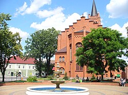
 Church of the Holiest Virgin Mary, the Queen of Poland | |
| Coordinates: 53°25′18″N 16°48′56″E / 53.42167°N 16.81556°E | |
| Country | |
| Voivodeship | Greater Poland |
| County | Złotów |
| Gmina | Jastrowie |
| First mentioned | 1363 |
| Town rights | 1602 |
| Area | |
• Total | 72.27 km2 (27.90 sq mi) |
| Population (2006) | |
• Total | 8,403 |
| • Density | 120/km2 (300/sq mi) |
| Time zone | UTC+1 (CET) |
| • Summer (DST) | UTC+2 (CEST) |
| Postal code | 64-915 |
| Vehicle registration | PZL |
| National roads | |
| Voivodeship roads | |
| Website | http://www.jastrowie.pl |
Jastrowie [jasˈtrɔvʲɛ] (German: Jastrow) is a town in northwestern Poland in Złotów County, Greater Poland Voivodeship.[1] It has 8,900 inhabitants (1998) and lies on the edge of the Gwda River valley. The town is located on the Osoka stream.
- ^ "Główny Urząd Statystyczny" [Central Statistical Office] (in Polish). Select Miejscowości (SIMC) tab, select fragment (min. 3 znaki), enter town name in the field below, click WYSZUKAJ (Search)


