Back جبال جيميز ARZ Jemez Mountains (kabukiran sa Tinipong Bansa, Sandoval County) CEB Jemez Mountains Czech Sierra de Jémez Spanish Monti Jemez Italian 헤이메즈산맥 Korean Jemez Mountains LLD Mont Jemez LMO Dził Łizhinii / Aniłtʼánii Dził NV
| Jemez Mountains | |
|---|---|
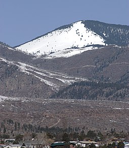
 Chicoma Mountain, the highest peak of the Jemez | |
| Highest point | |
| Peak | Chicoma Mountain |
| Elevation | 3,524 m (11,562 ft)[1] NAVD 88 |
| Coordinates | 36°00′26″N 106°23′04″W / 36.00722°N 106.38444°W |
| Geography | |
| Country | United States |
| State | New Mexico |
| Topo map | USGS Polvadera Peak (1977) |
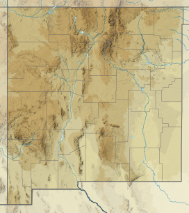
The Jemez Mountains (/ˈheɪmɛz/, Tewa: Tsąmpiye'ip'įn, Navajo: Dził Łizhinii) are a group of mountains in Rio Arriba, Sandoval, and Los Alamos counties, New Mexico, United States.
Numerous Puebloan Indian tribes have lived in the Jemez Mountains region for centuries before the Spanish arrived in New Mexico. The Pueblo Nations of this region are the Towa-speaking Jemez people, after whom the mountain range is named, and the Keres-speaking Zia People. Pueblos in the Jemez Mountains of New Mexico consisted of compact multistoried buildings which enclosed small plazas. Most of their several hundred rooms were probably occupied by single families, but some were storerooms.[2]
The Jemez Mountains include climates varying from desert at the lowest elevations to sub-arctic conditions at the highest elevations. A significant diversity of climate and vegetation is linked to gradients in elevation and the region's topographical features.[3] The highest point in the range is Chicoma Mountain (also spelled as Tschicoma or Tchicoma) at an elevation of 11,561 feet (3,524 meters). The town of Los Alamos and the Los Alamos National Laboratory adjoin the eastern side of the range while the town of Jemez Springs is to the west. Pajarito Mountain Ski Area is the only ski area in the Jemez. New Mexico State Highway 4 is the primary road that provides vehicular access to locations in the Jemez Mountains.
- ^ "Langley". NGS Data Sheet. National Geodetic Survey, National Oceanic and Atmospheric Administration, United States Department of Commerce. Retrieved 2008-12-22.
- ^ Fliedner, Dietrich. "PRE-SPANISH PUEBLOS IN NEW MEXICO". Annals of the Association of American Geographers. p. 16.
- ^ Cite error: The named reference
Craig Daniel-1989was invoked but never defined (see the help page).
