Back Jinzhou Qu CEB Jinzhou (Dalian) German Jinzhou (Dalian) Spanish Jinzhou barrutia Basque District de Jinzhou French Distrik Jinzhou ID Distretto di Jinzhou Italian 金州区 Japanese 진저우구 Korean Jinzhou (Dalian) NB
Jinzhou
金州区 Kinchow | ||||||||||||||||||||||||||||||||||
|---|---|---|---|---|---|---|---|---|---|---|---|---|---|---|---|---|---|---|---|---|---|---|---|---|---|---|---|---|---|---|---|---|---|---|
 | ||||||||||||||||||||||||||||||||||
| Coordinates: 39°05′55″N 121°43′13″E / 39.0985°N 121.7202°E[1] | ||||||||||||||||||||||||||||||||||
| Country | People's Republic of China | |||||||||||||||||||||||||||||||||
| Province | Liaoning | |||||||||||||||||||||||||||||||||
| Sub-provincial city | Dalian | |||||||||||||||||||||||||||||||||
| Area | ||||||||||||||||||||||||||||||||||
• Total | 1,352.54 km2 (522.22 sq mi) | |||||||||||||||||||||||||||||||||
| Population (2020) | ||||||||||||||||||||||||||||||||||
• Total | 1,545,491 | |||||||||||||||||||||||||||||||||
| • Density | 1,100/km2 (3,000/sq mi) | |||||||||||||||||||||||||||||||||
| Time zone | UTC+8 (China Standard) | |||||||||||||||||||||||||||||||||
| Postal code | 116100 | |||||||||||||||||||||||||||||||||
| Dalian district map |
| |||||||||||||||||||||||||||||||||
| Division code | 210213 | |||||||||||||||||||||||||||||||||
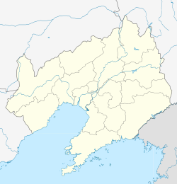
Jinzhou District (simplified Chinese: 金州区; traditional Chinese: 金州區; pinyin: Jīnzhōu Qū; lit. 'golden prefecture') is one of the seven districts of Dalian, Liaoning province, People's Republic of China. It is located about 20 kilometres (12 mi) northeast of the city centre and faces the Bohai Sea to the west as well as the Korea Bay to the east and has a longer history than Dalian itself, and used to be a thriving walled city where the officials of this area were dispatched from the central government. Recently, it is again a thriving town, having Dalian Development Area within its area as well as becoming a bedroom community to downtown Dalian. Its area is 1,352.54 square kilometres (522.22 sq mi) and its permanent population as of 2020[update] is 1,545,491.[3][2][4]

- ^ "Jinzhou" (Map). Google Maps. Retrieved 2014-07-02.
- ^ a b Dalian Statistical Yearbook 2012 (《大连统计年鉴2012》). Accessed 8 July 2014.
- ^ "Dàlián Shì (Sub-provincial City, China) - Population Statistics, Charts, Map and Location". www.citypopulation.de. Retrieved 2024-10-31.
- ^ 2010 Census county-by-county statistics (《中国2010年人口普查分县资料》). Accessed 8 July 2014.

