Back خولياكا Arabic خولياكا ARZ Hullaqa Aymara Juliaca (kapital sa distrito) CEB Juliaca Czech Juliaca Danish Juliaca German Juliaca Esperanto Juliaca Spanish Juliaca Basque
Juliaca
Hullaqa (Aymara) | |
|---|---|
| Nickname: Ciudad de los Vientos (The Windy City) | |
| Coordinates: 15°29′S 70°8′W / 15.483°S 70.133°W | |
| Country | Peru |
| Region | Puno |
| Province | San Román |
| District | Juliaca |
| Founded | 1630 |
| Incorporated | 3 October 1908 |
| Government | |
| • Type | Democracy |
| • Mayor | David Sucacahua (2019–2022) |
| Area | |
• Total | 533.47 km2 (205.97 sq mi) |
| Elevation | 3,825 m (12,549 ft) |
| Population (2017) | |
• Total | 276,110 |
• Estimate (2015)[1] | 273,882 |
| • Density | 520/km2 (1,300/sq mi) |
| Time zone | UTC-5 (PET) |
| • Summer (DST) | UTC-5 (PET) |
| Area code | +51 |
| Website | Official Website |
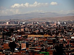
Juliaca (Spanish: [xuˈljaka]; Quechua and Aymara: Hullaqa) is the capital of San Román Province in the Puno Region of southeastern Peru. It is the region's largest city with a population of 276,110 inhabitants (2017).[2] On the Altiplano, Juliaca is 3,825 metres (12,549 ft) above sea level, is located on the Collao Plateau and is northwest of Lake Titicaca (45 km). It is the largest trade center in the Puno region.
Juliaca is near Chachas Lake, the Maravillas river, and near the ruins of Sillustani.
The city hosts Juliaca's Carnival each year between February and March. During this very popular event participants, dressed in colorful costumes, gather on the streets to dance in the style of the Collao Plateau. Saint Sebastian's feast is celebrated on 20 January of every year.
Juliaca's citizens rely on cars, trains, and bicycles. It is a major transit point in the region and has strong ties with Peru's southern cities, including Arequipa, Puno, Tacna, Cuzco, Ilo, and with La Rinconada and Bolivia.
Like Chicago, Illinois, it is nicknamed "The Windy City", in its case, because of the city's location on the windy Collao Plateau. It is also called the "Sock City" or "Knitting City" because Juliaca was a major center of sock, sweater, and handicraft production. Now the production of clothes, wool and fabrics are industrial processes.

It is also home to Inca Manco Capac Airport, the region's main airport.
- ^ Perú: Población estimada al 30 de junio y tasa de crecimiento de las ciudades capitales, por departamento, 2011 y 2015. Perú: Estimaciones y proyecciones de población total por sexo de las principales ciudades, 2012-2015 (Report). Instituto Nacional de Estadística e Informática. March 2012. Retrieved 4 June 2015.
- ^ Peruvian Census Archived 20 December 2010 at the Wayback Machine


