Back نهر جوروينا Arabic نهر جورينا ARZ Ríu Juruena AST Jurunea çayı Azerbaijani Журуена (река) Bulgarian Rio Juruena CEB Juruena Czech Журуэна (юханшыв) CV Rio Juruena German Río Juruena Spanish
| Juruena River | |
|---|---|
 | |
 Amazon Basin with the Juruena River highlighted | |
| Location | |
| Country | Brazil |
| Physical characteristics | |
| Source | |
| • location | Parecis plateau, Mato Grosso, Brazil |
| • coordinates | 14°43′6.0168″S 59°9′45.7848″W / 14.718338000°S 59.162718000°W |
| • elevation | 653 m (2,142 ft) |
| Mouth | Tapajós |
• location | Amazonas–Mato Grosso, Brazil |
• coordinates | 7°20′54.5856″S 58°8′11.9184″W / 7.348496000°S 58.136644000°W |
• elevation | 100 m (330 ft) |
| Length | 1,240 km (770 mi)[1] |
| Basin size | 191,780.7 km2 (74,046.9 sq mi)[2] to 192,628 km2 (74,374 sq mi)[3] |
| Discharge | |
| • location | Confluence of Teles Pires |
| • average | (Period: 1970-2000)4,458.513 m3/s (157,450.9 cu ft/s)[2] (Period: 1979-2015)4,936.7 m3/s (174,340 cu ft/s)[3] |
| • minimum | 1,766 m3/s (62,400 cu ft/s)[4] |
| • maximum | 11,348 m3/s (400,800 cu ft/s)[4] |
| Basin features | |
| Tributaries | |
| • left | Vermelho, Juína-Mirim, Camararé, Juína, Bararati |
| • right | São Tomé, São João da Barra, Arinos, Sangue, Papagaio |
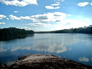
The Juruena River (Portuguese: Rio Juruena) is a 1,240 km (770 mi) long river in west-central Brazil, in the state of Mato Grosso.
- ^ Ziesler & Ardizzone 1979.
- ^ a b "Tapajos".
- ^ a b "PLANO ESTADUAL DE RECURSOS HÍDRICOS DO AMAZONAS, (PERH/AM) - RT 03 - DIAGNÓSTICO, PROGNÓSTICO E CENÁRIOS FUTUROS DO RECURSOS HÍDRICOS DO ESTADO - TOMO III" (PDF). January 2019. Archived from the original (PDF) on 6 May 2021. Retrieved 3 October 2021.
- ^ a b Mauricio E., Arias; Eunjee, Lee; Fabio, Farinosi; Fabio F., Poreira; Paul R., Moorcoft (2017). "Decoupling the effects of deforestation and climate variability in the Tapajós river basin in the Brazilian Amazon". doi:10.1002/hyp.11517.
{{cite web}}: Missing or empty|url=(help)
