Back كاندل Arabic کاندل (شهر) AZB Кандель (гӀала) CE Kandel (munisipyo) CEB Kandel (Pfalz) German Kandel (urbo) Esperanto Kandel (Palatinado) Spanish کاندل (شهر) Persian Kandel (Palatinat) French Kandel (Pfalz) Hungarian
You can help expand this article with text translated from the corresponding article in German. (June 2017) Click [show] for important translation instructions.
|
Kandel | |
|---|---|
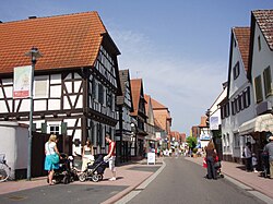
 Town centre | |
Location of Kandel within Germersheim district  | |
| Coordinates: 49°5′N 8°12′E / 49.083°N 8.200°E | |
| Country | Germany |
| State | Rhineland-Palatinate |
| District | Germersheim |
| Municipal assoc. | Kandel |
| Subdivisions | 3 |
| Government | |
| • Mayor (2024–28) | Michael Karl Gaudier[1] (CDU) |
| Area | |
• Total | 26.64 km2 (10.29 sq mi) |
| Elevation | 123 m (404 ft) |
| Population (2022-12-31)[2] | |
• Total | 9,212 |
| • Density | 350/km2 (900/sq mi) |
| Time zone | UTC+01:00 (CET) |
| • Summer (DST) | UTC+02:00 (CEST) |
| Postal codes | 76870 |
| Dialling codes | 07275 |
| Vehicle registration | GER |
| Website | www.kandel.de |
Kandel (German: [ˈkandl̩] ⓘ) is a town in the Germersheim district of Rhineland-Palatinate, Germany, near the border with France and approximately 18 km north-west of Karlsruhe, and 15 km south-east of Landau.
Kandel is twinned with the small Lancashire town of Whitworth.
Kandel is the seat of the Verbandsgemeinde ("collective municipality") Kandel.
- ^ Verbandsgemeinde Kandel, Landkreis Germersheim, Landeswahlleiter Rheinland-Pfalz, accessed June 9th, 2024.
- ^ "Bevölkerungsstand 2022, Kreise, Gemeinden, Verbandsgemeinden" (PDF) (in German). Statistisches Landesamt Rheinland-Pfalz. 2023.


