Back منطقة كانور Arabic كانور ARZ कन्नूर जिला Bihari কণ্ণুর জেলা Bengali/Bangla Districte de Kannur Catalan Kannur (distrito sa Indiya) CEB Kannur (Distrikt) German Distrito de Kannur Spanish Kannur barrutia Basque بخش کنور Persian
Kannur district
Cannanore district | |
|---|---|
|
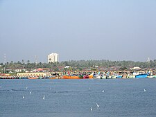
Clockwise from top: Vayalapra lake, Thalassery cuisine, St. Angelo Fort, Mappila Bay, Muzhappilangad Beach, Kannur International Airport. | |
| Nickname: Crown of Kerala | |
 Location in Kerala | |
| Coordinates: 11°52′08″N 75°21′20″E / 11.8689°N 75.35546°E | |
| Country | |
| State | Kerala |
| Established | 1957 |
| Headquarters | Kannur |
| Subdistricts | |
| Government | |
| • District Collector | Arun K Vijayan. IAS |
| • City Police Commissioner | R Ilango, IPS[1] |
| • Rural Superintendent of Police | Navneet Sharma, IPS[2] |
| Area | |
• Total | 2,966 km2 (1,145 sq mi) |
| • Rank | 5th |
| Population (2018)[3] | |
• Total | 2,615,266 |
| • Density | 882/km2 (2,280/sq mi) |
| Demonym | Kannurian |
| Languages | |
| • Official | Malayalam, English |
| Time zone | UTC+5:30 (IST) |
| ISO 3166 code | IN-KL-KNR, IN-KL |
| Vehicle registration |
|
| HDI (2005) | |
| Sex ratio | 1090 ♂/♀ |
| Literacy | 95.10% |
| Website | kannur |
Kannur (pronounced [kɐɳ.ɳuːr] ⓘ) is one of the 14 districts along the west coast in the state of Kerala, India. The city of Kannur is the district headquarters and gives the district its name. The old name, Cannanore, is the anglicized form of the Malayalam name "Kannur". Kannur district is bounded by Kasaragod District to the north, Kozhikode district to the south, Mahé district to the southwest and Wayanad District to the southeast. To the east, the district is bounded by the Western Ghats, which forms the border with the state of Karnataka (Kodagu district). The Arabian Sea lies to the west. Paithalmala is the highest point in Kannur District (1,372m). Enclosed within the southern part of the district is the Mahé district of the Union Territory of Puducherry. The district was established in 1957.
Kannur Municipal Corporation is the sixth-largest urban local body in the state and Kannur Cantonment is the only Cantonment Board in Kerala. Indian Naval Academy at Ezhimala is the Asia's largest, and the world's third-largest, naval academy.[5][6] Muzhappilangad beach is the longest Drive-In Beach in Asia and is featured among the top 6 best beaches for driving in the world in BBC article for Autos.[7][8] Kannur district is home to some forts which include St. Angelo Fort, and Tellicherry Fort. Thalassery town in the district is known for the Thalassery pepper.
Kannur is the sixth-most urbanised district in Kerala, with more than 50% of its residents living in urban areas. Kannur has an urban population of 1,640,986, which is the second largest in Kerala after Ernakulam district.[9][10] It was part of the Malabar District under the Madras province during the British Raj. Kannur district is divided into 9 Municipalities are Anthoor, Sreekandapuram, irrity, Thalassery, Koothuparamba, Kannur, Mattanur, Azhikode, Thaliparamba and panoor
- ^ "Who is Who". kannur.keralapolice.gov.in. Retrieved 21 February 2021.
- ^ "Major reshuffle in top posts in Kerala Police, S Sreejith to be Crime Branch chief". The News Minute. 1 January 2021. Retrieved 21 February 2021.
- ^ Annual Vital Statistics Report – 2018 (PDF). Thiruvananthapuram: Department of Economics and Statistics, Government of Kerala. 2020. p. 55.
- ^ "Kerala | UNDP in India". UNDP.
- ^ Ray, Kalyan (11 August 2017). "Navy-Training Academy-proposed Expansion". Deccan Herald. Retrieved 24 March 2022.
- ^ "Asia's largest naval academy opened". Arab News. 10 January 2009. Retrieved 24 March 2022.
- ^ Gibson, David K. "The best beaches for driving". Retrieved 26 June 2016.
- ^ Harigovind (24 June 2016). "Muzhappilangad wins BBC favour". Deccan Chronicle. Retrieved 24 March 2022.
- ^ "Population of Districts in India - 2001" (PDF). Archived from the original (PDF) on 28 November 2010. Retrieved 24 November 2010.
- ^ "Untitled Document". Archived from the original on 25 July 2014. Retrieved 26 May 2009.


