Back Municipio de Kawthaung Spanish ကော့သောင်းမြို့နယ် Burmese ၵေႃႉတွင်း၊ ၸႄႈဝဵင်း SHN Kawthoung Swedish อำเภอเกาะสอง Thai 高當鎮區 Chinese
This article needs additional citations for verification. (January 2021) |
Kawthaung Township | |
|---|---|
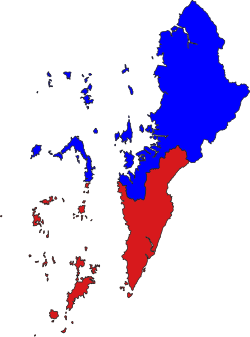
 Location in Kawthaung district | |
| Coordinates: 9°59′N 98°33′E / 9.983°N 98.550°E | |
| Country | |
| Region | Taninthayi Region |
| District | Kawthaung District |
| Capital | Kawthaung |
| Area | |
• Total | 2,527 km2 (976 sq mi) |
| Population (2014) | 140,020 |
| Time zone | UTC+6.30 (MST) |
Kawthaung Township (Burmese: ကော့သောင်းမြို့နယ်; Thai: เกาะสอง, RTGS: Ko Song; meaning Second Island or Twice Island) is a township of Kawthaung District in the Taninthayi Division of Myanmar. The principal town is Kawthaung. The township covers an area of 2,527 km2, and had a population of 140,020 at the 2014 Census.[1]
- ^ CityPopulation.de. "KAWTHAUNG". Archived from the original on 19 January 2020. Retrieved 28 August 2020.
